Friday, February 28, 2020

Reports of Snow Showers!

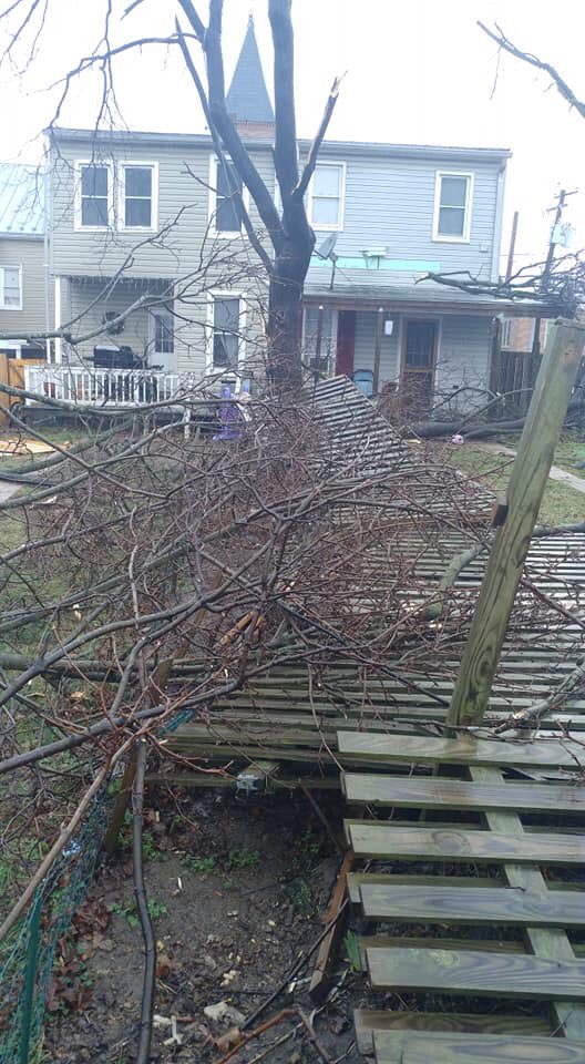
Many people across the DMV, including the Baltimore metro, saw snow falling today. Surprisingly, no snow fell at BWI, so according to weather history(if it doesn't snow tomorrow), this will be the first snowless February ever for BWI(this has never happened before!). I found reports of snow falling in Dulles, Leesburg, Poolesville, the Baltimore metro, and I saw snow falling in Gaithersburg(3 rounds so far. I made a document on snowfall this season, and I made a report on EVERY time snow fell. Here is the report:

02/28/2020: Flurries/Snow Showers started to fall at around 2:30 PM and lasted until 2:38 PM. It was above 32 degrees when snow fell, so the snow melted on contact. At 4:41 PM, moderate snow started to fall. It stuck to surfaces but melted after a while. At 4:45 PM, the snow became lighter and turned into flurries/snow showers. Snow ended at around 4:53 PM. At around 4:57PM, snow started to fall again. It was light snow(flurries/snow showers, and it didn't stick to surfaces(melted on contact). It ended at 5PM.


I am not sure if this true, but I think that this could be the first time in history for Dulles, BWI, and Gaithersburg where we have no measurable snow in February(even if this has already happened it will be one of the few rare times this happens)(the only other snow event that happened was when I saw a dusting of snow on 02/07/2020)(the day when the tornado warnings happened)(not measurable though). A trace of snow is when any amount of snow has fallen and stuck to the ground, not measurable snow. This winter has been pathetic. I have only recorded 4.8" of snow so far, and that is much below average(average is 21" for Gaithersburg). Hopefully, March is better, but from the way it's looking so far, it looks like most of March will be just feel like and be an early start spring(temps look to be above average for March). This doesn't mean that we cannot have snow OR that we don't have a below-average temp day, thankfully. Hopefully next year will be better!

Thursday, February 27, 2020

Chance of Snow Showers for the DMV Friday?

Yes, snowfall this year has been so drastic that even a chance or mention of snow showers gets its own post. There is a chance of snow showers/flurries for the DMV on Friday, mainly between 12-4PM. However, this could also just be rain(a sprinkle/very light shower) or it can be mixed rain/snow if it even happens. If this happens, I don't think there will be measurable snow, but there could be some accumulation, but mainly in our northwestern areas in MoCo(and areas north and west of MoCo). It is possible we could see flurries tonight, but that is mainly in Damascus(and a little bit of northern Clarksburg). Again, there could be some accumulation tonight since it is below freezing in those areas, but not any measurable snow.  This could be our last chance for some places(Baltimore)(I think that Dulles got some snow in this month) to get snow(see snow falling and sticking) and is most likely our last chance to see measurable snow(unlikely, but possible). Anyways, this month has been basically snowless. Hopefully, this cold front will give us some snow! I hope that March will give us that big snowstorm students across MoCo are all hoping for(5"+ of snow). Anyways, the winter season is almost over, which means that I will be making some more non-winter weather posts in the upcoming days and weeks. The severe weather season looks to be very interesting, and something to watch.

Wednesday, February 26, 2020

Weather Update

There is a pretty good chance of thunderstorms and showers tonight, specifically between 9:30AM Wednesday-1AM Thursday. There is a chance of tornadoes, but it is pretty low. It could happen though, you never know, but it seems unlikely. We could get a severe thunderstorm, but again, there is a low-medium chance of that happening(has a better chance of happening than a tornado though)(35-51% chance). There will be a strong thunderstorm, potentially a severe thunderstorm(best chances to the west of MoCo)(strongest thunderstorms may be west of MoCo).  After today, it will get much colder and windier through Thursday(cold front moving in which gives us cold winds). The cold front is supposed to last from 2/27/2020-3/2/2020.  3/05/2020-3/11/2020 is supposed to have normal(average temperatures). Cherry blossoms are already in the process of blooming in many places and have bloomed already in some places in the DMV(mainly D.C. and south)! They are in the process of blooming(starting to come out of their buds) in my yard, in Gaithersburg!


But where is the winter? So far, I have ONLY recorded 4.8 inches of snow in Gaithersburg, but most reports show people getting around 3" of snow, with a lot of places getting below that. Some places are getting more than that, but those places are north and west(Fredrick County, Loudoun County, Shenandoah Valley, Blue Ridge, Mountains, Garrett County, Allegany County, Washington County, etc.). The reason for the lack of snow is not the lack of precipitation; in fact, it is the exact opposite. We are having lots of precipitation(rain), but what we are lacking cold air. The Polar Vortex is locked up in the north(Canada, Alaska) and is not collapsing(giving the lower 48 cold air). So far, there is 0.6" of snow in Reagan National(its been a year since an inch or more of snow there), 2.9" of snow in IAD(Dulles), and 1.8" of snow in BWI(Baltimore)(if it doesn't snow this February, this will be the first time there will be a snowless February in Baltimore). These snow totals are way, way, way below average for this moment in time, let alone seasonal. If we want above-average snow, we need a major snowstorm in March(10-12"+). We need at least 52" of snow if Reagan National wants to keep it's average the same(15.4" of snow). This is a very long shot from happening, let alone getting above-average snowfall this year. This cold front could be our last chance for getting snow before spring comes(it is basically already here). I am not saying it is our last chance for snow this year, but I am counting on this to give us a good snowstorm.

Friday, February 21, 2020

Trace of snow in DCA!

Reagan National was able to pick up a trace of snow Thursday night/12-1AM Friday morning! IAD(Dulles) and BWI(Baltimore/Washington International) didn't see any snow. However, they weren't able to measure the snow. This puts DC safe from having a snowless February, which has only happened once! Winter is not over. We still have March, and we are expected to go in a more colder, stormier pattern going into March(Feb 28-Mar 5 is expected to be colder than average temps)(I am not sure past that). If we can get some precipitation, we could see some snow! Snowfall can still continue after March, though it is very, very rare. I predict a snowstorm in march(4"+ at least)(5-6"+ is what I am thinking though). The reason we have been lacking snow this year is that when cold air gets here, there is no precipitation, but when we have precipitation, there is no cold air. The precipitation isn't locked in with the cold air(we aren't lacking precipitation though, just cold air). If every rain event so far this winter was snow, we could have seen over 60" of snow, probably more than that!

Wednesday, February 19, 2020

Another snow threat?

There is a snow threat on Thursday afternoon through Thursday evening. With cold air staying in place(it is supposed to get cold tonight) and highs in the upper 30's to the lower 40's, and lows in the teens(20 in some places), we could see some light snow. This could give us a quick dusting, but the best chances for snow in this county is the most southern part. Areas south of DC have a higher chance to see snow. However, this system could miss us to the south. NC and Southern VA will probably get snow(they could see above 1 inch of snow). I will be watching this system very closely, and will give you updates.


The Capital Weather Gang's post about the snow chances(potential is still at 1 but is trending higher)(chances of 1"+).


Friday, February 7, 2020

Snow Showers and Tornado Warnings In The Same Day?!!??!

Today, was truly, a remarkable day. I don't think that this has ever happened before, even before I was born in this area. There was a tornado today, along with snow showers today, IN FEBRUARY. There were reports of tornadoes in Poolesville/Dickerson, Westminster, Southern Fredrick County, and Leesburg(Confirmed EF-0 tornado in Leesburg, VA). The damage done was a lot. A wind advisory with gusts 50-60 mph+ today, plus with a severe thunderstorm before 9AM. We didn't get tons of rain, instead, we got... something way better. This will go down in weather history. And to top it all off, there were snow showers tonight, in Damascus and GBurg(probably more places in MoCo as well). Snow in the mountains, blizzard conditions in New England, a bomb cyclone: this storm was definitely remarkable. Today will go down in weather history. All I have to say is... Maryland weather is weird. Update: Snow is becoming much heavier. There is a confirmed EF-1 tornado in Cecil County, MD.
Image
Westminster, MD Tornado Damage(credit: Joseph Bowers)


Flurries after a tornado warning in Damascus, MD. (Credit: Ryan Douglas).
Image


Tornado Damage in Leesburg(credit: Joe Spevak)


Image

Maryland Weather Meme(credit: Martin Amini)


THERE IS A TORNADO WARNING FOR CLARKSBURG!!

THERE IS A TORNADO WARNING FOR CLARKSBURG AND OTHER NORTHERN PARTS OF MOCO!!!! GET SHELTER IMMEDIATELY!!! THIS LASTS UNTIL 8:15 AM!!! THE TORNADO IS VERY CLOSE TO GAITHERSBURG, UPPER MOCO TAKE SHELTER!! THERE IS A WIND ADVISORY FOR ALL OF MOCO AND MD AND A WIND WARNING FOR CITIES NEAR THE OCEAN/DELAWARE!


"As this area of showers moves through the region, a brief period of
extremely heavy rainfall, small hail, and gusty winds of 30 to 40
mph are likely. A couple storms could have severe wind gusts over 60
mph. If driving, you should be prepared for a sudden sharp drop in visibility and slippery roads. The heaviest showers and storms
should move through the immediate DC and Baltimore areas within the next hour, with lighter rain expected after 830 AM."-NWS


THE WIND ADVISORY LASTS UNTIL 3PM!!! THERE IS ALSO A SEVERE THUNDERSTORM WARNING FOR DAMASCUS AND CLARKSBURG(THE UPPER PART OF MOCO)!!!


Tuesday, February 4, 2020

Another Winter Weather Threat for the DMV Saturday Night-Sunday?

There is a winter weather threat for the DMV that takes place on Saturday Night to Sunday. This is definitely something to watch, as this time of year we get our most snow. This is not a major storm, but there could be accumulations. The low-pressure wave will be just below the border of Virginia and North Carolina. You usually want the low-pressure wave to be below your location as it usually means that you will get a part of the storm. The GFS and Euro models are showing snow falling and accumulating. This storm, as of right now, seems to be snow to a mix to rain, the changeover to rain depends on how north and west you are. This wave will ride the boundary the leftover Thursday/Friday rainstorm. Since this is over 100 hours away, everything is uncertain. You might be thinking, "Pfft... there's no way the snow is going to accumulate! Temps are way too mild and warm this week for any accumulating snow!", and you are right. It is going to be mild this week, but after Friday, it is going to become cold again(below freezing that night). That will make surface temps lower, and by the time the snow arrives, temps will be cold enough or close to cold enough for some accumulating snow(the snow will accumulate on untreated surfaces because snow will make them below freezing). If the snow falls fast enough, the snow will stick. There could be ice as well, but that part is VERY uncertain. The tweet from Mike Thomas shows what the Euro is showing for 4:30 AM Sunday.


Model Snow Amounts(and other stuff):

Euro:
This shows 1-2 inches for MoCo, with some areas getting 2+ inches of snow(less than 3 inches though)(total accumulated snow).

The Euro showing snow at Saturday 4PM.

The GFS:

The Mid-Atlantic gets hit with moderate to heavy snow(light in some areas)(1AM Sunday).


Snow Depth at 1AM Sunday(less than an inch).


The GFS shows 0-1.5" of accumulated snow at 7AM(not snow depth)(snow that accumulated).


Scales(same for both Euro and GFS):
Snow accumulation scale


Precipitation Intensity(per hour)


Featured Post

2/17 Overnight Moderate Event for DC/Balt Metros

A low-pressure system tracking in southern VA will bring our region snow again. It will move out fast, but will bring good dynamics with it,...