Showing posts with label Special Weather Statement. Show all posts

Thursday, March 4, 2021

NWS Announces That Special Weather Statements and Advisories Won't Be Used Again by 2024

 The National Weather Service today announced that advisories for weather events like wind, flooding, and winter weather will not be used again(exception: Tsunami and Small Craft Advisories), and this also includes special weather statements. This is some really big news to hear since this will change the way weather forecasters predict and the whole system of the NWS forever. In this post, I will be going over:

- Why this is happening

- What will be happening in the future

- My opinion

You can also read the whole document that the NWS made at:

https://www.weather.gov/media/notification/pdf2/pns21-12_haz_simp_headlines.pdf

Why This is Happening:

But why is this happening in the first place? Well, it's because research done by the NWS shows that Advisory headlines cause confusion within the general public, who don't understand the weather alert system that well. The term itself is often misunderstood and is often compared to a Watch(meaning that dangerous weather may be happening soon). This misunderstanding can lead to confusion of the forecast and may hinder the preparation of people trying to get ready for the weather, usually for the worse. The NWS wants to make it more obvious about the weather hazard and wants people to have less confusion and misunderstanding.

What Will Be Happening In the Future:

All of the advisory headlines that are in the NWS' "Watch, Warning, and Advisory" system will be discontinued. Most of them will be replaced with "plain-language headlines" that will be made in an effort to clearly announce and state the nature of the hazard. They will still have the "Valid Time Event Code" (VTEC) as we do right now. All special weather statements will be discontinued, however, they will have a computer-readable VTEC and will be placed in a "What, Where, When, Impacts" type of format. The exact language used in those headlines is yet to be determined but will be determined in the next couple of years. Everything else would be either watches or warnings. Some advisory-level events might become warning or watch criteria. For example, 4-5 inches of snow(still technically advisory level right now) could become a winter storm warning once these changes are implemented.

My Opinion:

My opinion about this decision is that it's good, but I don't agree with implementing this everywhere. Why? First of all, we have been using this system for a very long time; maybe even since the NWS was founded! It is going to take a long time for everyone to get adapted to this whole system, and this will create more confusion. And my worry is that with these "plain-language headlines" that people will have even more confusion! There is already a lot of confusion between watch and warning, and I feel like removing advisories would cause a little bit more confusion. Since I don't have much experience forecasting weather that isn't winter-related, I am not sure how it will work with other weather, but I have enough information about winter weather to make an educated opinion. Winter weather advisories should be there in the DMV. Maybe not for areas like New England and the Midwest, but since our winter-weather events are generally on the smaller side, we should still have advisories, because like I said, people will take it less seriously if there isn't one. I agree with the decision to remove special weather statements though, they don't really do much. Overall, I think it is a good decision, but some changes need to be done to it.

I will be giving more updates to this decision as I get more information. And I know, I haven't been posting too much recently, because of the boring weather pattern. However, winter is not over until its really over. Models are showing an interesting pattern for mid-March. I will make a post on Saturday/Sunday explaining it when I have more details and information. I told everyone that in La Nina winters, something usually comes up in March, even if that winter so far was bad. And well... there you have it! Something came up! Winter isn't over until its TRULY over. Don't throw away the thick, winter coat just yet. The weather will be really nice next week, and some areas could get into the 70's!

Sunday, February 21, 2021

Final Monday Clipper Update

 This will be a minor event, and will also be a quick one. This event is a snow to mix to rain type of event. However, the timing of the storm could disrupt the morning rush hour. The snow is expected to generally start after sunrise, but a lot of storms this year have started earlier than expected, so I think it could start before sunrise. The impacts would be greater if it did. There is a winter weather advisory for Northern MoCo, stating snow accumulations of 1-3 inches of snow, and a special weather statement for Southern MoCo, stating the possibility of snow impacting the rush hour. We will see how it plays out, if temps are colder than expected I think we could see an advisory in Southern MoCo. Let's look at some models.

GFS:


The GFS shows light snow turning over into moderate-heavy rain. Snow rates will be moderate, and possibly heavy at times. Be vary if traveling.

The GFS shows almost no snow. I don't agree with this.

European:

The European model shows snow moving in around 7-10 AM and then shows it turning into a mix, and then eventually, rain. Northern zones have the most time with snow and mixing before turning into rain. I know that it doesn't show snow, but that's only because it shows 6-hour blocks, so it likely shows some sort of snow before turning into a mix. The same applies to the mix turning into plain old rain.
The European shows 1-4 inches of snow, with 3-4 inches in Damascus and 1-2 inches in Bethesda. This is assuming a 10:1 ratio of course, and I assume Kuchera ratios have less snow, but I don't have access to it. 


HRRR:

The HRRR shows snow turning into a mix but also shows the snow trying to fight back a bit at the end of the storm. It shows some rain getting in, but mainly in southern MoCo. This seems to be one of the more colder solutions. If heavy precipitation caused good dynamic cooling, this solution could be possible. We should be below freezing on the onset and slowly rise above freezing as we go later into the day.
The HRRR shows 1-3 inches of snow, with the most snow in Damascus and the least snow in Bethesda.

NAM(12km):


The NAM shows the snow starting around 8-10 AM and then turning into an icy mix before turning into rain.

The NAM shows up to an inch of snow, with the most in Damascus and least in Bethesda.


The NAM, unfortunately, shows a lot of ice; 0.15 - 0.3 inches of ice, which would be enough to break some trees and cause spotty power outages. Hopefully, this doesn't play out and we see less ice and more snow.

NWS: 

The NWS shows 1-2 inches for most of Northern MoCo, less than one inch in Southern MoCo, and 2-3 inches in Damascus. 

For this clipper, a trace to an inch of snow possible in Southern MoCo, with localized areas possibly seeing a bit more, and 1-3 inches in Northern MoCo. The most snow will be in Damascus, and in Northern MoCo, like usual. Everyone will start out as snow, then turn into a mix, eventually, turning into all rain. Northern areas will see the longest period of time with snow and mixed precipitation. I don't expect much in ice accumulation if there is even any. Temps will rise above freezing around noon, but snow can still fall while it's at or above 32. The storm may start before sunrise(even though it's expected to start after sunrise), due to a history of storms this year starting a bit earlier than expected. This will be a low-impact storm, but still should be taken carefully. Snow may fall at a moderate, and maybe even heavy rate at times. 

Monday, February 8, 2021

Freezing Rain Possible Tomorrow

There is a chance for some spotty freezing rain tomorrow morning. If we were to see some, the most we would have is a glaze of ice. There is a special weather statement for the entire county, including our neighboring counties. This won't have too much of an impact, however with the colder temps recently, this ice can make roads and untreated surfaces slick. If you have to run any errands or do something tomorrow morning, take caution and do them. This won't and shouldn't disrupt any plans. However, we are watching a bigger threat on Wednesday-Friday that if materialized could cause disruptions. A new post will be coming shortly.


From the NWS:

"Special Weather Statement
National Weather Service Baltimore MD/Washington DC
1127 AM EST Mon Feb 8 2021

DCZ001-MDZ013-014-016-503>506-VAZ052>057-501-502-505-506-090000-
District of Columbia-Prince Georges-Anne Arundel-Charles-
Northwest Montgomery-Central and Southeast Montgomery-
Northwest Howard-Central and Southeast Howard-
Prince William/Manassas/Manassas Park-Fairfax-
Arlington/Falls Church/Alexandria-Stafford-Spotsylvania-
King George-Northern Fauquier-Southern Fauquier-Western Loudoun-
Eastern Loudoun-
Including the cities of Washington, Bowie, Suitland-Silver Hill,
Clinton, College Park, Greenbelt, Laurel, Camp Springs,
Glen Burnie, Annapolis, Severn, South Gate, Severna Park, Arnold,
Odenton, St. Charles, Waldorf, Germantown, Damascus, Bethesda,
Rockville, Gaithersburg, Silver Spring, Lisbon, Columbia,
Ellicott City, Dale City, Manassas, Woodbridge, Lake Ridge,
Montclair, Reston, Herndon, Annandale, Centreville, Chantilly,
McLean, Franconia, Arlington, Alexandria, Falls Church, Falmouth,
Fredericksburg, Dahlgren, Warrenton, Turnbull, Purcellville,
Leesburg, Ashburn, and Sterling
1127 AM EST Mon Feb 8 2021

...POTENTIAL WINTER COMMUTING HAZARD FOR THE WASHINGTON AND
FREDERICKSBURG METROPOLITAN AREAS TUESDAY MORNING...

There is a potential for hazardous commuting conditions for the
Tuesday morning commute. A period of light freezing rain is
POSSIBLE (a 30 percent chance) Tuesday morning across the
Washington and Fredericksburg Metropolitan areas. A light glaze of
ice is possible on area roads.

If this threat does materialize during the Tuesday morning rush-
hour, many roads could quickly turn icy. This could lead to
dangerous traveling conditions, multiple accidents, and extensive
delays.

If commuting Tuesday morning, be aware of the POSSIBILITY of
significant travel disruptions. Plan ahead by allowing for extra
travel time, and consider using telework options.

Stay tuned for updates on this potential winter weather episode."

Thursday, February 4, 2021

100th Post! Friday Storm Update and Sunday Storm News

 Well, this is the 100th post of this blog. 🎉But we also have a lot of storm potentials in the next upcoming days/week. Let's talk about the most recent one: Friday. This event will be a light, mostly insignificant event. There is a special weather statement for Northern MoCo, that states:

 "There is a potential for hazardous commuting conditions for the Friday morning commute. A period of snow, possibly mixed with sleet and freezing rain is POSSIBLE (a 50 percent chance) Friday morning across the northwestern suburbs of the Baltimore / Washington metro area with potentially up to an inch of snow along with a light ice accumulation on area roads. If this threat does materialize during the Friday morning rush-hour, many roads could turn icy. This could lead to dangerous traveling conditions, multiple accidents, and extensive delays."

Even though it says up to an inch of snow, I still think that the most we will see out of this event will be from a coating to a half-inch, if we even see any accumulation. We might see all rain too, that's definitely a likely possibillity. Temps should mainly remain above freezing, but they may dip down a bit. The NWS shows less than an inch from this weak "storm"(image below).


Now let's talk about the Sunday threat. Models are trying to pull it back in for our area and with the exception of the GEM(CMC), they all show some snow on Sunday. This storm, if it does materialize, will be a short-duration event, not a long-duration event like we just had. They are all showing a northern trend. That usually doesn't work for us, but in this case, it actually does. However, even with that being said, we should wait until tomorrow just to see if it's a fluke(if it is it will disappear tomorrow), or if it will be an actual threat.
GFS:


The GFS shows the storm coming in from the south at around morning.  Once it comes, it starts as moderate-heavy snow, then starts to taper off into light-moderate snow. It shows the storm done by the afternoon hours. Surface and upper air temps(850mb) are below freezing, so they should be able to support snow.
NAM(12km):


Now, the NAM, compared to the other models, is the most bullish. It shows heavy snowfall rates in a short period of time. It shows the storm starting in the early morning hours on Sunday and ending in the afternoon hours. Compared to the other models, it shows less bullish rates and snow accumulation. However, the trends seem to be favoring the NAM at the moment.

European Model:
The European model barely shows light snow hitting our area. This is good though, we aren't in the bullseye yet. If you are in the bullseye this far out, the bullseye usually will shift far away from you. This is an improvement to last time.


Now, this is something to watch. Our county, and most of the DMV, are at a risk for heavy snow, from the time period of February 12-February 18. This is a slight risk, so a 20% chance, but still encouraging to see.

In conclusion, we have many storm threats to watch. Models are trying to bring back snow on Sunday, and by tomorrow, we will know if this will be a threat or just nothing.

Sunday, March 22, 2020

Mixed Precipitation Possible Sunday Night to Monday Early AM

There is a chance that we will see some mixed precipitation(this could mean sleet, freezing rain, snow, mixed rain and snow, etc.). However, that chance increases the further north you go. The Blue Ridge and the Allegany Front will probably see snow, sleet, and/or freezing rain, with minor accumulations expected. However, for MoCo, even if we do see mixed precipitation, there will be no accumulation at all. Temps will be too high for any sticking. This will either change into rain or stay rain all throughout the course of this night(depending on where you live). However, in the hazardous weather outlook issued by the NWS for our county said that pockets of freezing rain may continue into Monday morning, however, I think they are talking about the mountains. Damascus' elevation is around 800 feet, so mixed precip there is pretty plausible(I am not saying that it is likely, but I am saying that that area has a better chance than the rest of the county). The NWS shows mixed precip EXPECTED for half the county valid Sunday-Monday(8AM)(however this map is very zoomed out so I can't really see if it covers the whole county or just a certain part). I don't think everyone will see mixed precip, but it is definitely possible, and not out of the question.


The National Weather Service shows mixed precip for about half the county, happening between 8 AM Sun-8 AM Mon.

Friday, February 7, 2020

Snow Showers and Tornado Warnings In The Same Day?!!??!

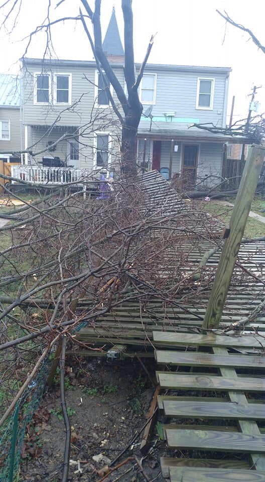
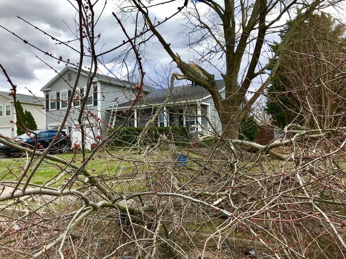
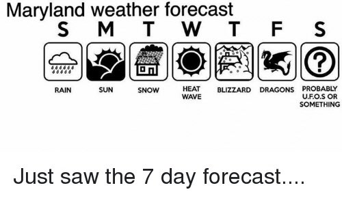
Today, was truly, a remarkable day. I don't think that this has ever happened before, even before I was born in this area. There was a tornado today, along with snow showers today, IN FEBRUARY. There were reports of tornadoes in Poolesville/Dickerson, Westminster, Southern Fredrick County, and Leesburg(Confirmed EF-0 tornado in Leesburg, VA). The damage done was a lot. A wind advisory with gusts 50-60 mph+ today, plus with a severe thunderstorm before 9AM. We didn't get tons of rain, instead, we got... something way better. This will go down in weather history. And to top it all off, there were snow showers tonight, in Damascus and GBurg(probably more places in MoCo as well). Snow in the mountains, blizzard conditions in New England, a bomb cyclone: this storm was definitely remarkable. Today will go down in weather history. All I have to say is... Maryland weather is weird. Update: Snow is becoming much heavier. There is a confirmed EF-1 tornado in Cecil County, MD.
Image
Westminster, MD Tornado Damage(credit: Joseph Bowers)


Flurries after a tornado warning in Damascus, MD. (Credit: Ryan Douglas).
Image


Tornado Damage in Leesburg(credit: Joe Spevak)


Image

Maryland Weather Meme(credit: Martin Amini)


Friday, January 31, 2020

Update Page Out

I just made this post so that you know that the update page is out. Again, this won't be replacing blog posts, but it will just be quick updates. Blog posts will have predictions and more thorough and informative updates. It will be a page titled "Update Page". To find the page, just look in the "Pages" section. Again, thank you for 1000 views. I will make a daily forecast on Sunday.

Tuesday, January 28, 2020

Coastal Storm on Friday/Saturday/Sunday and Announcement

There is a coastal storm that is possible on Friday Night-Saturday to maybe early morning Sunday that could bring us some winter weather(ice, snow, sleet, etc.). It is definitely something to watch because the system(at least some models show) has the perfect track for a good snowstorm, it is just missing cold air, that would bring us snow. Right now, models are showing either our area being dry(or virga)(when precipitation falls but doesn't reach the ground because it is too dry) or lots of rain, but no winter weather. However, models are very jumpy and the track of the storm will definitely change. Don't go out clearing the store shelves yet, because it is way too early to determine if there will be a snowstorm or not. We will get a better idea of this storm by Thursday, which is when I will make my next update about this storm. Right now, I will be watching the models and Mike Thomas(meteorologist at FOX 5)'s twitter because he is giving lots of updates about this storm. Also, I have an idea to make an update page. This page will include small updates about the weather, like pictures and captions. The reason I'm doing this is that if an "important" thing about the weather, like a winter weather threat or a change in maps, I won't have to create a new post. Don't worry, I will still create posts, I will just be giving more small updates much more quickly. It takes a lot of time to make a blog post, and 1 small update could change my whole blog(if it is really big like 3" becoming 3', I will make a separate blog post). It is just easier, hopefully you understand and are fine with this change! Also, as of 1-28-2020(10:15 PM), our website has been viewed 960 times. That is a pretty big number. Only 40 views away from 1000 views! Thank you for reading my posts!

Where to find Models:

https://www.pivotalweather.com/

https://weather.us/

Friday, January 17, 2020

Winter Weather Threat Friday/Saturday Update

Prediction: All MCPS activities on Saturday will be canceled, MCPS building services at least delayed and a 51% chance of closure(they will monitor weather conditions and decide to close on the conditions outside).

Sorry for the delayed update, this post was supposed to come out Wednesday(1/15/2020)

The winter threat is still there, but the snow amounts have gone down lower(this usually happens). Now, there seems to be lot of other precipitation than just pure snow as well, such as sleet, freezing rain, and cold rain(the order I said these types of precipitation is what order the precipitation is expected to fall for this storm). This is a Cold Air Damming event (CAD)(meaning: a high-pressure system that goes from west to east with an associated cold front)(there is warm air above the cold front that covers the cloud)(cold front/air means 32 degrees or lower)(the above 32 degrees air is above the dome of cold air)(warm air= 32+ degree weather).

CAD Picture(from Wikipedia)(it shows and explains it better than I do):


Do you see how it uses areas of the DMV? Anyways, the clouds and precipitation fall in the above 32 degrees weather, but when the precip reaches the dome, the precip turns into either snow, sleet, or freezing rain. The type of precip depends on the depth of the cold air. If the dome is really high, we will get snow, if the dome is medium, we will get sleet, if it is somewhat low, we will get ice. Anyways, the NWS has put a winter weather advisory for all of MoCo, which starts at 7AM Saturday, and ends at 7PM Saturday(for the whole county). The advisory says, "Snow, sleet and freezing rain expected. Total snow and sleet accumulations of up to one inch and ice accumulations of up to one-tenth of an inch." It also says that the wintry mix will turn into the plain cold rain. WUSA 9 has released its first call for the wintry mix! I will show the ice and snow/sleet accumulation maps.


As you can see, most of MoCo is in the D-1" area, and Damascus(and extreme eastern/northern Clarksburg) is in the 1-2"+ area(this means that 1-2" will fall but there is a lot more potential for more than that). It says that snow and ice will accumulate quickly(because Friday and Saturday temps will barely rise above freezing). All snow and ice will stick, so anything untreated will have snow. This is a very interesting map because usually places more north and west get more snow, but this time, places north and EAST get more snow. Howard County has more of its county in the 1-2"+ area. Anyways, let's look at the ice accumulation map!


Most of MoCo is in the "Up To 0.1"" of ice area(Glazing-0.1" of ice), while the same area of MoCo who are in the 1-2"+ of snow are in the 0.1-0.25" of ice area. This means that there is enough ice to make sidewalks and roads slick and ice-covered, but in Damascus, there is a possibility of downed tree branches, and even power outages(0.25" of ice is enough to cause power outages and downed tree branches)(0.25"> of ice is enough to do those, but there is less of a chance that they will happen). If this happened on Friday, I would give 3.5/4 snowflakes for this storm. Ice is not a joke, and we're not talking about a glazing(like in December). No, we are talking about 0.01-0.25" of ice, and that's serious(in Damascus). This time, the biggest accumulations are north and far west of MoCo(Eastern West Virginia)(Frederick County, Hagerstown). East and South are the big losers here(most people will see glazing east and south of MoCo, or no ice at all). This much ice will make everything slick, and because it's so cold today and tomorrow, at least 85% of the ice will stick(probably 99% of it). Anyways, let's look at the NWS maps now!


As you can see, the eastern 13/16 of MoCo is in the 1-2" of snow area, while the other 3/16 is in the less than 1-inch area. This is the total amount of snow that will fall during this storm, and this is the most optimistic snow map out of all the snow maps I am going to show. However, the advisory says amounts "up to an inch", but this map shows at least an inch for almost the whole county, and some areas of the county could receive 2 inches, but most areas will get between 1 and 2 inches of snow(1-2"). I don't know why they don't say up to 2 inches in the advisory, according to this map, the advisory should say snow and sleet accumulations up to 2 inches. This is the most optimistic map about snow accumulations, because most of the other maps say a Dusting-1" for most of the county, with 1"+(1-2" usually) for Damascus. Let's look at the ice accumulation maps now!


As you can see most of MoCo is expected to have some ice accumulation(at least 0.01" of ice for most of the county). However, I think that the part of the county that won't get ice will get some ice, but it will be a light glaze. This shows 0.01-0.1" for most of the county, which is enough to make everything slick, but Damascus and a few other areas will get at least 0.1" of ice and could get a quarter-inch of ice. North and west of MoCo are expected to get the most ice. There's not really that much else to say about this map, because I already said it in the WUSA 9 map. Now let's look at the NBC 4 map!


As you can see, 3/4 of MoCo is in the "Up to 1" area(Dusting to 1 inch) and the other 1/4 is in the 1-2" of snow area. Even though this isn't a lot of snow, every flake that falls will stick and make icy and slick surfaces. An inch of snow will definitely cause lots of impacts and delays, it will be slick outside, and with the sleet and freezing rain, the roads/sidewalks will become really icy and slick and become very dangerous. The snow will also be much harder to remove, so I recommend salting roads and sidewalks before the storm.  In this map, areas north and west will get the most snow. NBC 4 doesn't have an ice accumulation map, so we will move on to the next maps!(Note: I won't be explaining the maps because the maps are very similar and everything I will say about them will already be said).


As you can see, most of MoCo is in the 1>" of snow area, while Damascus is in the 1-2" of snow area. The amount of snow, according to this map, depends on how north or south you are(east and west don't really matter). North of MoCo will get 1-2", while south of MoCo will get less than an inch. (This doesn't have an ice map). Let's move on to Fox 5's map!


Most of MoCo is in the C-1" of snow area(some slick roads here), and the upper 1/4 of MoCo is in the 1-3" of snow area. All of MoCo will have snow-covered and slick roads according to this map.  If you live north of MoCo(and west of Baltimore County), you will see 1-3" of snow. (No ice map).


Verdict for this storm: Moderate Impacts(4.25/10 for areas south of Gaithersburg)(4.6/10 for Gaithersburg and northern MoCo)(5/10 for Damascus) (1 being lowest impacts, 10 being the highest).


I put "Moderate Impacts" for this storm. Why? Well, it's because of that all snow that falls will stick to all surfaces if the surfaces are untreated, which means slick and snow-covered roads and sidewalks. There won't be that much snow, so I wouldn't put this in high impacts, but there is freezing rain, and that will make the snow harder to shovel and there is enough ice to create slick roads and sidewalks. There might be a little gap where nothing falls, and that slightly lowers the impacts, but still, temps will be below freezing, and the snow will freeze, making it harder to shovel and plow. Also, models typically tend to underestimate how long the below-freezing air will stay in these CAD events, so the whole county could see freezing rain until 5:30 PM Saturday. Damascus could have freezing rain until 7:30-8:30 PM(when temps will be at or below freezing). When it gets dark, it is going to be hard to see whether roads are wet or slick, so drivers will have to be careful at night and drive slowly, otherwise, a surface that looks wet may be icy, and their vehicle could skid. Walking slowly and carefully is advised, otherwise, you might slip. The freezing rain will make this system moderately impacted and will be the main concern, along with the sleet. Sleet basically has the same impacts as snow, so snow accumulations could also include sleet and could create totals of more than an inch of snow in areas that were expected not to get snow. The wintry mix will become rain at around 5:30- 8:30 PM(when temps will be above freezing). The impacts would be significantly higher if the storm wasn't on a weekend. Ice won't really melt when the rain falls, so even at 9PM, there could still be some slick roads. Sunday morning could have slick spots, but probably not. Overall, this storm is not that big in terms of snow accumulations but will create some impact due to the freezing rain.


Tuesday, January 7, 2020

Wednesday 1-08-2020 Prediction

This storm seemed like a bust at first, but then all of us got our "thump"(very heavy rate of snow falling in a small amount of time) and we got the expected amount. The amount of snow all of us got in MoCo is 0.5-3", depending on where you live, but I have heard reports far west of the county getting close to 6". I got 2" of snow in Gaithersburg. It snowed so heavily in that thump that when I wiped the snow off of my car, there was already a coating on the car 1 minute and 30 seconds later. If the snow rate in that "thump" lasted even longer we could get 6-12", or even more than that. Main roads are mostly wet with some slush in them, but sidewalks and secondary/neighborhood roads? Oh they are a mess. My neighborhood road has snow on it, slush, and some black ice. Anyways, the reason we are talking about delays/closures is because temps tonight for the whole county will be below 32 degrees. Even where roads are wet, they will become icy and slick because the temps will refreeze the water to ice. I have seen reports from Clarksburg and Damascus where everything is snow covered and slushy. Tomorrow will be a huge mess. Temps aren't supposed to be above 32 degrees until 8-9AM tomorrow, and the ice, snow, and slush will make the morning commute and rush hour a mess. There is a special weather statement for all of MoCo, stating about slush, snow, and water refreezing into ice, and says that even if a surface looks wet it might be ice, so to be careful about where you step and be cautious about black ice, slush, etc. Even if elementary schoolers went to school at the normal time, there would still be slush and/or snow, and even ice(depending where they live). Slush is the main concern for everyone in the county, until 10AM to 12PM(again, depending where they live). NBC 4 thinks we will have a delay(they said to plan on sleeping in) and I can see where they come from, but I also see why other people think we won't have a delay. A delay would not only give crews and the sun 2 extra hours to treat and clear the snow, but also kids would be able to see the ice/slush/snow easier.

Prediction: 3 snowflakes
I am leaning towards a delay and not a closure because temps need to be below freezing for longer than 9 AM for a closure or same temps but 3.5"+ of snow. A delay would help a lot, and going on time would make roads and sidewalks filled with ice, snow, and slush, and would make the chance of students getting severe injuries a lot higher than if they delayed. By 11AM/12PM, most snow should be cleared and there won't be that much slush, and MCPS wants to get as much school hours as they can while considering their students safety, so a delay would be the best option for MCPS(even though most students want a day off :P). Opening on time would have lots of injuries, crashes, and even the possibility of buses sliding off roads.

Monday, January 6, 2020

Tuesday Threat Update and Prediction

 UPDATE: WINTER WEATHER ADVISORY FOR ALL OF MOCO. 1-3" OF SNOW EXPECTED. IT ALSO SAYS VISIBILITY COULD BE LESS THAN 1/2 OF A MILE AT TIMES, AND COULD EXCEED 1 INCH OF SNOW PER HOUR!

This snow threat has just boomed since yesterday, and all the models(except HRRR) show at least 0.4 inches of snow. The Euro shows 1.2-1.6"(1.6-2" in some areas)(anything in parentheses is the majority amount for the county), the ICON shows 0.4-0.8 inches(0.8-1.2" in some areas, 0.2-0.4" in some areas), and the GFS shows 0.8-1.2"(1.2-1.6" for NE areas, 1.6-2" for Damascus, and 0.4-0.8 inches for Bethesda). This storm will start at 11AM-12PM, starting as rain for some, mixed rain/snow for most, and pure snow for NE areas. By 1-2PM, it should be all snow for the whole county, and by 7PM the system should be out. Most of the snow should stick on the grass(more snow sticks on sidewalks/roads the more north you go), but visibility is a problem and so is slush. Temps should be hovering above freezing, so snow will have a harder time sticking to the ground. However, it will be a huge mess. Mixed rain and snow will cause slush, and since temps are 33-35 degrees, slush can come as an outcome of this storm, mainly in our north areas. Slush is slippery, and it will be a mess outside. Even if temps are above freezing, it could still stick to sidewalks and neighborhood roads. Since temps are 33-35, if the snow falls at a moderate to heavy rate, it could stick to areas students will walk on, and then those areas will become slippery and students will be vulnerable to falling and getting serious injuries. By 3PM, there could already be an inch of snow on the ground, and at1PM there will only be a coating. If enough snow falls at a heavy enough rate, it will stick to sidewalks and roads and/or make those surfaces very slick. Anyways, let's look at the maps now! First, we have our map from the NWS. PREDICTION:  2 snowflakes(delay chance is early release chance)(65% chance of early release)(30% chance of no school)(modified)(see rating system)(not 2.5 snowflakes because closure chance not as high)(look down for details)


The NWS predicts 1-2" FOR THE WHOLE COUNTY and 2-3" for the upper quarter of MoCo. This means that the NWS thinks 1-3 inches throughout the whole county. 1 inch of snow should be enough to cause issues throughout the whole county, and it gets far worse the more north you go. Some places could get 3 inches! This is enough snow to cause an early dismissal. This will definitely cause issues with the afternoon commute. If this forecast is correct, after school activities will be cancelled, and this will probably cause an early release. 3-4PM is supposed to be when the snow is at its heaviest. That is when lots of students get dismissed(elementary school students), and some high school students(Poolesville High School students) leave school at 4:30PM, and it is probably already  snowed enough to make everything slick, slushy, and icy. January is the coldest month of the year, so sun angle isn't a factor and temps should find a way to make surfaces at least a little bit slushy. Now, lets at Capital Weather Gang's map!


As you can see, most of MoCo is in the 1-3" area.The C-2" area says that most of the accumulation is on the grass, but the 1-3" area says SLICK ROADS POSSIBLE. This means that if slick roads are possible, slick/slushy sidewalks are likely. All of MoCo (according to this map) won't be getting a mix. Just because the C-2" area doesn't have as much snow potential as the 1-3" area doesn't mean that they will get less snow than the dark blue(dark blue will get more snow than the light blue area)(most likely). It just means that they don't have as much potential than the dark blue area to get more than 2 inches; they just probably won't get over 2"(a place in C-2" could get 2" and a place in 1-3" could get 1"). A place from the light blue area can get more than the dark blue area; it is just less likely. This is a map that I agree with; however, I think the C-2" area(not including MoCo) will have mixing in some spots. This map(if most correct) would cancel after school activities, and we would have an early release(if this map was the most correct I would go 57/43 with the early release).(this map was updated due to the new advisories). (1-3" area could get 3-5" if the totals are more than what is forecasted, C-2" area would get 2-4" if more snow falls than what is expected, 1-3" area could get 1"> if less snow falls than what is expected, C-2" area could get a bare ground if less snow falls than expected)(bare ground means that snow will fall but it won't stick to anything, not even grass). Now, let us look at WUSA 9's map!

(UPDATE: ALL OF MOCO IS IN 1-3" OF SNOW AREA NOW! IT ALSO DOESN'T SAY SNOW WILL MAINLY BE ON GRASSY AND ELEVATED SURFACES! 65% chance of early release!) This map has about 51% of MoCo in the D-1" area, while the other 49% is in the 1-2" area. However, since MoCo is so close to the 1-2" area, for MoCo (specifically), this map will show 0.65-2" for the whole county. The map says that the gray area's accumulations will be mainly on grassy and elevated surfaces(i think for only the gray area?!), so the impact wouldn't be that bad in those areas(maybe some delays)(same with the white area but much more delays and some cancellations). Despite how much snow these maps show, after school activities will be cancelled. This could still cause some slick spots, 0.85"+ is enough to make roads slippery, at least a little bit. This could still definitely cause an early release, I am just not as confident as I would be compared to the other two maps we already saw. Anyways, let's look at the NBC 4 map now


As you can see, 5/6 of MoCo is in the 2-4" area, while the other 1/6 is in 1-2" area. This is enough snow to cause delays and even cancellations(3"+ of snow usually will cancel school if it snows the whole day)! This is far more than enough snow to cause roads/sidewalks to be slick and/or slushy and even snow covered! If this was correct I would go (75% of early release, 25% full day). Now, let's look at the details for my prediction!


Mixed rain/snow turning into snow around 12 PM and ending at 7PM will really put a wrench into the afternoon/evening commute. The snow amounts are 1"+ for lots of places in the county, and the snow is expected to fall at a moderate rate. By 1 PM, there could be a coating on the ground, and by 3 PM, there could be an inch! The snow will fall fast, and even if temps are 32<, the snow will be able to fall fast enough to stick to bus stops and sidewalks, and even secondary/neighborhood roads in upcounty will be affected! There is a huge difference of snow on the ground between 1 PM and 3PM, and by 3 PM, there should be enough snow that has fallen on the ground to make surfaces(sidewalks, bus stops, etc.) slushy and/or slick, especially in upcounty! If they release early, students will get to home easily with no injuries due to weather! Visibility will be low, and it will take longer for students to get home if released on the normal time. The reason I think there won't be a delay or closure is because snow will fall after the delay time and it would have no effect, and no closure because it won't be snowing the whole day, only the afternoon, so closing wouldn't happen, because MCPS would try to get as much hours of school they can while still taking the student's safety into consideration.I am leaning towards a delay because there will be a significant difference of snow on the ground if released early compared to normal dismissal. Upcounty will be a huge mess, and the amount of snow we are talking about is enough to cause some issues on the roads(more of a slush/slick problem, not snow accumulation problem). It will be dangerous for students to walk on slushy sidewalks, and even slick spots because these increase the chances drastically of a student breaking a bone and falling. There are some places that won't see a plow for a long time, so the snow will be an issue for who knows long before it gets removed. Also, since winter weather advisories have just been released for the whole county this increases the chance of an early release(since all of MoCo is in the advisory). The advisory tells people that this is something that could disrupt their  plans and will make people aware  that there is a winter weather threat that could be potentially harmful for your health. It also says at times visibility could be less than 1/2 of a mile at times, and that snowfall rates could EXCEED 1 inch per snow per hour. These are near blizzard conditions(visibility). Walkers will suffer a lot, because they can't see that well and 1 inch per hour+? Walkers will suffer even more(more snow to walk through and snow will stick to almost everything so more slick and slushy spots) and snow will stick to almost everything, since the rate is so heavy that it will reduce surface temps to 32(maybe even lower), that there will be slush and black ice everywhere. This is all if MCPS doesn't release early. If they do, all of this will be avoided. If they don't, well... R.I.P. Walkers. This could cause a delay the next day(Wednesday), so stay tuned for that(temps 32> Wednesday Morning and Tuesday Night).

Sunday, January 5, 2020

Tuesday Snow Threat(first snow threat of the new decade/year!)

On Tuesday, there is a chance for winter weather. The weather is supposed to be mixed rain and snow, with some all snow weather happening for places in N&W MoCo(including Northern downcounty), and some all rain for places in S&E MoCo. The accumulations of this won't be significant(Coating-1"), but it could have a threat and is definitely something to watch out for. The timings of this storm would give us an early release(the timings are 12:30PM-7PM)(4PM for GFS)(if there would be an impact). Temperatures should be above freezing when the precipitation falls, so the snow/mixed snow and rain won't probably won't stick on roads/sidewalks, but more on grassy areas. The NWS has given a yellow rating(slight threat)(threat could cause minor disruptions) for N and W MoCo, but no threat for S and E MoCo. This is probably is because in Southern MoCo, there will mostly rain. In terms of accumulations, there would be a trace(0.05") to 1 inch of snow. Icy spots and snow sticking wouldn't really be an issue, but slush could. Slush is as bad as snow sticking, but I am not even sure there would be slush to begin with. Because of this, I don't think there will be an impact. However, temps will fall below freezing Tuesday night, so it is possible that the rain/snow could refreeze and could cause some icy spots the next day. I will be watching this and give an update tomorrow about this threat.

Saturday, January 4, 2020

Winter Forecasts for the 2019-2020 Winter!(snowfall)(FIRST POST OF 2020!)

Yes, this is the moment you have been waiting for, the WINTER FORECASTS FOR 2019-2020! In my opinion, these forecasts predict good snow for this year(average to above average), but others predict below average.

Here is FOX 5's forecast:               
Fox 5 predicts 25-35 inches for the upper 1/3 of the county and 15-25 inches for the other 2/3 of the county. The more north you live in the county, the more snow you will get(I would say we are in the 20-30 inches range).
 
   
Here is NBC 4's winter forecast for this year:
  NBC 4's forecast is a jackpot for snow. Southern MoCo will get 18-26"(amounts to the higher end) and Middle and Northern MoCo will get 28-37"(that is a lot!). According to Doug Kammerer, he is going for about 50% more snowfall than average. "I think we’re going to see a couple of pretty good storms, meaning 6 to 10" snowstorms or 6 to 12" snowstorms," said Doug.
Here is WUSA 9's forecast:
 WUSA 9 expects a La Nada winter this season. This means that there could be a lot of snow, or very little snow. They are saying that cities that are in the beltway(basically the southern half of MoCo) will receive below-average snow, but since we are on the edges, I will say that the Southern half of MoCo gets 1-3 inches below average, probably less than that. This winter map is predicting is average to above-average snowfall this year(about). The other half of MoCo should be getting above-average snow. We are in the 10-30" range(15-30 is better estimated for the whole county).

Here is ABC 7's forecast:
This shows awfully below-average snow for our county. 7-22 inches?! We get can 7 inches and more in 1 snowstorm, this is the forecast that is the least optimistic. Most of MoCo is in the 12-22" area, while the other part of MoCo is in the 7-17" area. This forecast is extremely below average, but not as bad as the 2017 and 2018 winter.

The Capital Weather Gang's Forecast:

According to Capital Weather Gang, the 2nd half of winter(very late January to end of winter)(late March) will be harsh(lots of snow and cold temps) after a gentle start(non-significant snow events)(4">)(normal temps). That means the whole month of February(and early March) will be the prime time for snowstorms. Anyways, 55% of MoCo is in the 14-24" range(places 1000'< have a higher chance of getting 24"+) and the other northern 45% is in the 22-34" area(areas 1000'< will most likely have 34"+ of snow). Montgomery County(specifically) will get 15-25" of snow. This map shows around average to slightly below average snowfall. Now, let's look at the average of these maps!


Fox 5: 15-35" of snow.

NBC 4: 18-37" of snow.

WUSA 9: 19-30" of snow. 

ABC 7: 7-22" of snow.

Capital Weather Gang: 15-25" of snow.

AND THE AVERAGE OF THESE MAPS ARE... 14.8 inches- 29.8 inches of snow! Is this below average snow for MoCo. Above-average? The average amount of snow(for MoCo) is 16-27" of snow(Bethesda-Damascus)! So, the 2020 winter will have an average of 22.3" this year(snow amount most people will get). The average amount of snow is 21.5"(for the county as a whole)! So, the 2020 winter will have(according to these maps) will have above average snowfall(0.8" more!)!! WE WILL HAVE ABOVE AVERAGE SNOWFALL! This is good if you are a snow lover and/or you want more snow days(and delays). NBC 4 has the most optimistic map for snowfall, while ABC 7 is the least optimistic map for snowfall. Overall, we will get(according to my predictions)(based on the maps) 3-7 snow days this year(we already had one)! Delays won't be predicted because delays depend on how much small snow events there are(Alberta clippers) and freezing rain(melts before 10:45 AM). There is no predictions for freezing rain, so it is way harder to predict. If I had to take a wild guess, I would say 5-13 delays this year, though I am pretty sure I will be wrong. We also have subzero temperatures and wind chills to deal with, so it makes it even harder for me to predict. This winter should be good, so stay tuned to my posts! Thanks for reading!

Sunday, December 15, 2019

Prediction for Monday Snow/Ice

Now, everyone is aware of this threat and is making maps/predictions for this threats. Not all of the news channels maps are out, but they will be out soon. Anyways, there is an advisory for N&W MoCo, while there is a special weather statement for S&E MoCo. The advisory says 1-2 inches of snow, with a light glaze of ice(still enough to cause issues)! The timings say the system will start 1-4 AM, and the snow will change to a wintry mix of ice/sleet. It says by Monday afternoon, it should be all rain. The statement says that the snow/sleet is possible Monday morning, mainly after 4 AM. The accumulations say up to 1 inch, with no expectations of ice. It should be mostly rain by 11 AM-12 PM. This system is difficult to predict if there will delays or not, but NOAA has a map predicting if there will be delays or not. Now, lets look at it!
As you can see, MoCo(as a whole) is in the Probable zone, which means that there is a 70-85% chance of a delay, so for our county, they are leaning towards a delay. I can see why they would say that, since there's ice and snow happening in the rush hour, and it shouldn't be rain until 11AM-12PM. Lets look at where NBC 4 thinks the impacts will be!
About 60% of MoCo is in the "Biggest Impacts" area, while the other 40% is in the minor impacts. Northern Rockville and any place north than that will have the biggest impacts. This means that delay are likely and closures are possible. Since the majority of MoCo will have the biggest impacts(and since MCPS makes a decision for the whole county), they might have to delay. We are going to look at WUSA 9's snowfall map.
As you can see from WUSA 9's map, about 86% of MoCo is in the Trace-1" area, while Damascus and Barnesville is in the 1-2" area. And here is the bad part: After you go south of MoCo, there is no snow accumulation expected. That means that we are the edge of snow accumulations. This will not give us much impacts, but we still have the freezing rain that may convince MCPS for a delay. Howard Bernstein himself said in a tweet that this advisory/system will be more on the ice and sleet. Now lets look at the ice accumulation map by NWS.
According to this, about 50.01% of the county will see some ice accumlation. It is not expected to be over a tenth of ice, but a few hundredths of ice. This is still enough to cause delays and impacts. Like I said before in my earlier posts, even a small amount of ice is enough to cause widespread delays/closures and impacts. Now let's look at the NWS snowfall map! UPDATE: REPORTING 2 INCHES OF SNOW IN GAITHERSBURG.

The NWS upped their snowfall totals, with about 45% of the county in the 1-2" area now. The other 55% is in the <1" area, but since they are close to the 1-2 inches area, the other 55% of MoCo should be in the 0.5-1" areas. Now lets look at what ABC 7 thinks will happen in our area!
ABC 7 says light snow to ice to regular rain for the whole county, while Damascus is in the snow to ice area(accumulations likely!). This map says that delays are likely. Now, with all this info, it is time to make my snowflake prediction!

Snowflake Prediction: 3 snowflakes(find ratings at the ratings page)


Unlike the last time we had a system like this(last Tuesday), this is way bigger of a threat. Ice, with snow, and with the mix changing to rain around 11AM-12PM, has a much higher chance of a delay and closure becomes a possibility. In our N and W suburbs, it will be a mess. Temperatures will be below or at the freezing mark tonight, so snow and ice will stick to sidewalks, and even roads(most likely salted though). It has been a lot colder lately, and it wasn't that warm today (<50 degrees). It will be snowing at when students leave for school, with snow sticking in most places with the temps below or at freezing, so a delay will most likely be needed. About the closure chance. Yes, I do think there is a chance of closure, but this is because the cold air(wintry mix) will stay long enough in some places that when the high schoolers/middle schoolers go to school at a delayed opening, there will still be ice/snow. The closure will happen IF the cold air stays long enough(until 11:45AM-12:00PM or longer) for the snow/ice to accumulate. They will send students on a delay if the rain starts at 10-11AM. If the amounts are to the higher end, I would say a closure(3.5 snowflakes), but not much people are saying/suggesting a closure and there will have to be ice accumulations for at least 75% of the county. If the whole county has an inch or more with ice accumulations that make slick spots, there will be a closure. S&E MoCo is in a Special Weather Statement, which implies that there might be impacts, but they will be very insignificant. An advisory means that there will be impacts, and they might be somewhat significant. A closure could happen even with the same amounts, but the accumulations have to stay for long. They make a decision for the whole county, so they might "ignore" that and close. There will have to be a little bit more ice/snow/sleet for a closure(like 0.1 inches more for snow/sleet)(0.01-0.03" more ice), and they have to last long(10:50AM and longer).(UPDATE: NO SCHOOL FOR MCPS 12/16/2019).

Featured Post

Archival of Blogger and Move To Substack

Hello everyone, I'm making this post as a formal gesture that I have fully moved to Substack and will not be using this website anymore....