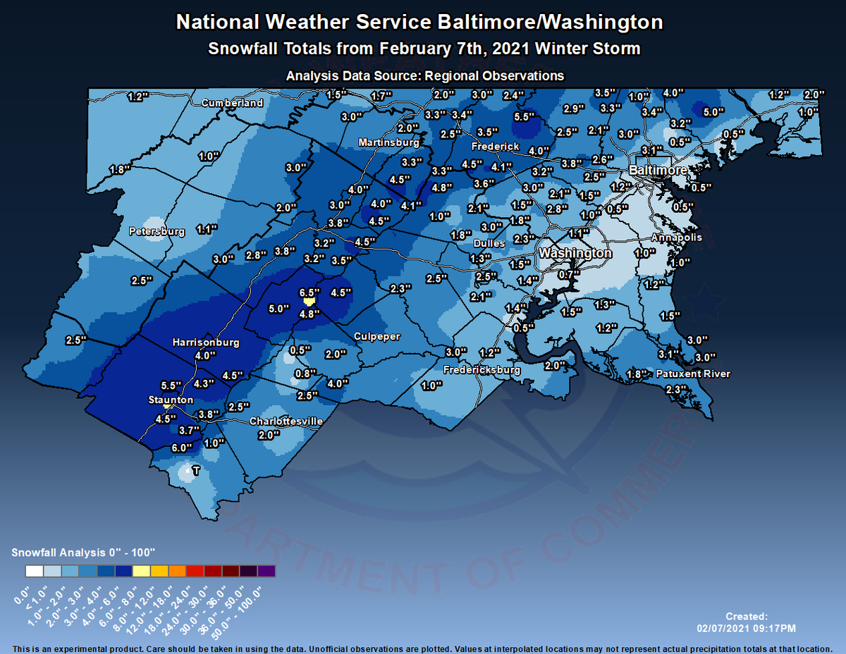
So overall, this storm wasn't too bad, even though the snow totals up there look bad. According to this map, around 1-3 inches of snow fell, but in localized areas, from what I have heard, around 2-5 inches of snow fell. I myself measured 4.2 inches of snow, which includes compacting and melting, bringing up my winter total(so far) to 17.2 inches of snow. It started out as rain and turned into wet, heavy flakes. Snow won over the marginal temps and accumulated on any untreated surfaces, but quickly melted as precipitation became lighter/stopped. This storm ended as mixed rain and snow, at least for me. Now, as temps quickly drop, any wet surface will become ice rapidly. A flash freeze is likely. My forecast was a little bit less than expected, but it still verified!
But now, I want to talk about the storm chances we have coming up. We have a slight threat for Wednesday-Friday. This is our next system we will be monitoring.
The NWS shows a slight winter threat for Wednesday into Thursday, for Northern MoCo, and no threat for the I-95 Corridor(southern MoCo). Now, I won't go into too much detail(since this post is mainly for the Sunday storm recap) but all wintry precipitation types are on the table for this. It all depends on the placement of the Arctic ULL, the more south it is, the more cold air and snow we will get. This is looking like a moderate to possibly heavy event(in terms of snowfall), but anything could change this far. The main part of this event for snow/wintry precipitation is between Thursday-Friday, as you will see by the image below.
The NWS shows an enhanced threat for Northern MoCo and a slight threat for the I-95 Corridor(southern MoCo). The bulk of the wintry precipitation seems to be here, and this is why we might have moderate-heavy snowfall totals.
But there is one more threat I want to talk about. And yes, it falls on a Sunday(let's keep this a weekly thing). And although this is far out, if this threat were to materialize, it would definitely be a significant storm, with some of the models showing heavy to even SEVERE snowfall totals! Now, this is very far out and will change over the course of the week, but it's definitely something to watch. We have at least 2 storm chances before Valentine's day.


No comments:
Post a Comment