If you are an early riser and live in a generally southern area of MoCo, you might have seen some flurries or maybe even a snow shower outside. Well, that storm is over. Now we move onto the next: Saturday-Sunday. There is a winter weather advisory for the entire county, stating up to 1/10 inches of ice, and for freezing rain with sleet mixed at times to fall. Thankfully, the models have been trending for less precipitation, and therefore less ice, but this is still to be taken seriously. This is at least a moderate ice event. I would highly recommend trying to move any plans on Saturday and Sunday to a later date. 1 PM to 11 PM Saturday will be the key timing for this storm when the ice will accumulate the most.
GFS:
The GFS shows a scattered wintry mix of sleet and freezing rain rather than an organized storm(and that second part coming from the west doesn't hit us).The GFS shows 0.025 - 0.1 inches of ice. It has been trending for less ice(freezing rain) and more sleet.NAM(12KM):
The NAM shows an icy mix instead of just freezing rain. It shows it is over fast.
The NAM shows 0.01-0.05 inches of ice.
European:
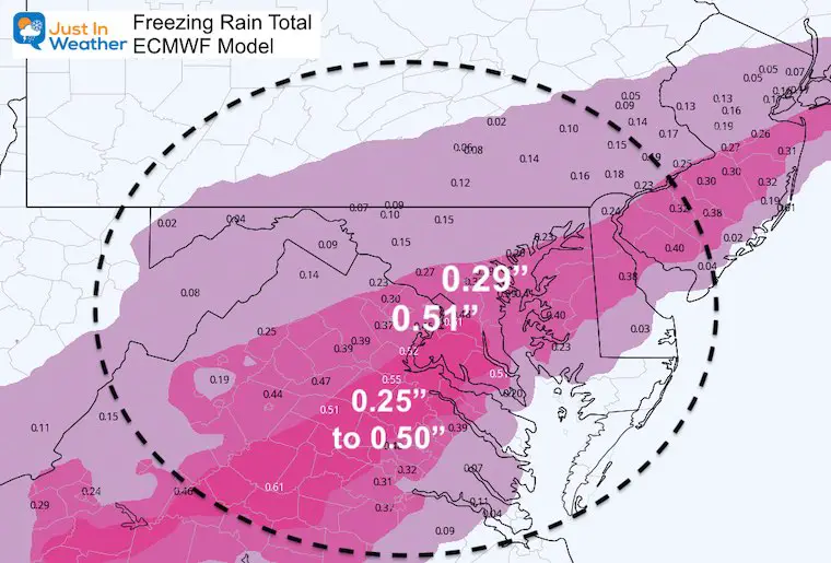
The European has been the most aggressive model for this storm since the day it showed up, and to now. It shows 12 hours of moderate-heavy freezing rain for the whole county before moving out.
 |
| Image Courtesy of Justin Weather |
Capital Weather Gang:
The Capital Weather Gang has most of our county in the "Moderate Threat" area with the northern cap of our county in the "Slight Threat" area. They expect hazardous untreated surfaces for all of our county, and 0.05-0.2 inches of ice, with some sleet mixing in.


No comments:
Post a Comment