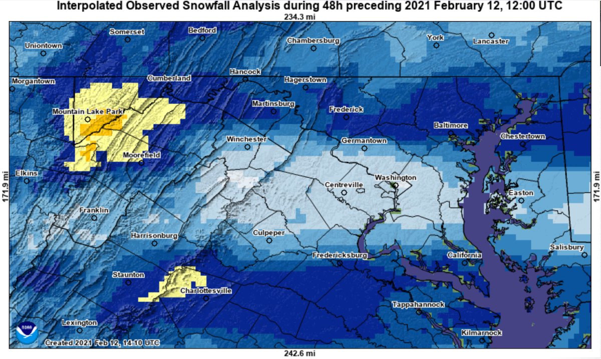
This storm is a classic example of "Don't believe model snow totals even a couple of days out." The models were showing a really good storm, but as we got closer, the models immediately showed much less snow.
This is the amount of snow that fell during this storm. Less than an inch, all the way up to 6 inches of snow fell. You can see the gradient here. Less than an inch for southern MoCo, 1-2 inches for lower-upper MoCo, and upper-lower MoCo, 2-3 inches for more interior northern MoCo, 3-4 inches for NE MoCo, and 4-6 inches for Damascus. Snow started around the early evening hours(4-6 PM), and then went on, tapering off/lightening a bit around 7-9 PM, then picked up again, but this time started turning over into sleet or a mix. This continued for the rest of Wednesday and started to switch over into snow again during the early morning hours for Thursday as the sleet/snow line pushed south. Then, it kept snowing until the late morning/early afternoon hours. Then, the main bulk of the storm was done. We had a few flurries Thursday night into Friday morning, but that was about it for the storm.


No comments:
Post a Comment