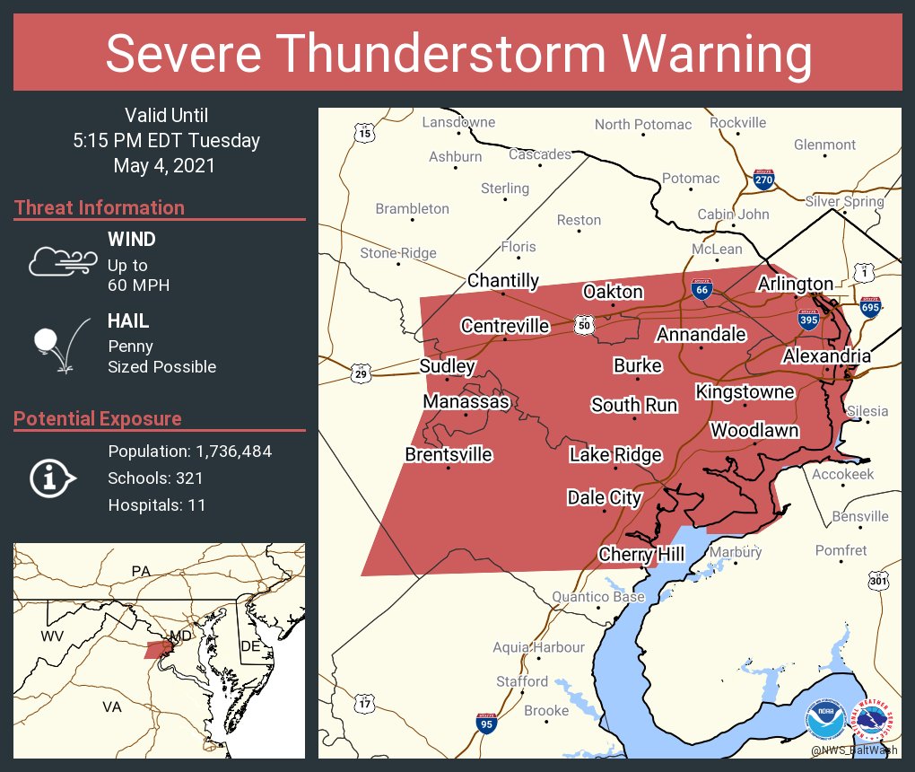
4:30 PM:
There is a severe thunderstorm warning for most of Fairfax County and just west of DC. 60 MPH wind and penny sized hail is possible.
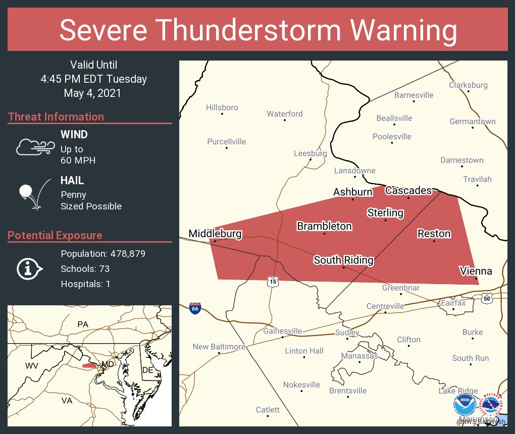
4:05 PM:
There is a severe thunderstorm warning for southern Loudoun County and Northern Fairfax county! Penny sized hail and 60 MPH wind is possible! Seek shelter inside now!
3:55 PM:
The SPC has issued a mesoscale discussion for most of our area, stating the risk for damaging winds and isolated hail that's severe.
2:00 PM:
THERE IS A SEVERE THUNDERSTORM WATCH FOR ALMOST ALL OF MARYLAND AND VA, AND ALL OF THE REGION. WIND UP TO 70 MPH, PING PONG HAIL, WHICH IS UP TO 1.5" HAIL, AND FREQUENT LIGHTNING IS POSSIBLE. THAT SIZE OF HAIL CAN MAKE YOU SERIOUSLY INJURED. THIS IS VERY DANGEROUS. PLEASE TAKE THIS SERIOUSLY! 12.5 MILLION PEOPLE ARE AFFECTED BY THIS!
As said in the previous post, there is a chance for severe weather today too. The sun is out in many places, allowing for instability to rise. Southern MoCo is in the slight risk, and Northern MoCo is in the marginal risk for severe weather. The timing is from mid-afternoon through this evening. The main threat are large hail and damaging winds, but a tornado cannot be ruled out.
As you can see, our northern and generally western areas are in the marginal risk, while southern and generally eastern areas are in the slight risk.
Most of the region is in a tornado risk, with only our far western and far northern areas in the <2% risk. In the green, is a 2% chance to see tornadoes 25 miles away from any point.
This is the hail risk for today. All of the area are in the 5% chance to see 1" or larger hail 25 miles away from any point. This does not include less than 1 inch hail.
This is why there is a slight risk for DC and Southern MoCo. There is a 15% chance in the yellow to see 65 or higher MPH winds from thunderstorms 25 miles away from any given point, while a 5% to see the same thing in the green.
The SPC has issued a mesoscale discussion for the following area, stating strong to severe storms bringing up a significant wind threat. In that area, there is an 80% chance of a severe storm watch being issued.
The 12z HRRR, at 4 PM EDT, shows 500-1000 MLCAPE across the region, with a little bit more in some regions. This amount would be enough to cause some storms to form.
The lift is between -2 C and - 5 C throughout the region. This will be enough to cause some storms to form.
There isn't much shear in the atmosphere at this time, but lets look at a sounding.
This sounding isn't favorable for tornadoes. There are decent CAPE and lapse rates, but bad shear. Dew point is good though.
I will update this post whenever something happens.


No comments:
Post a Comment