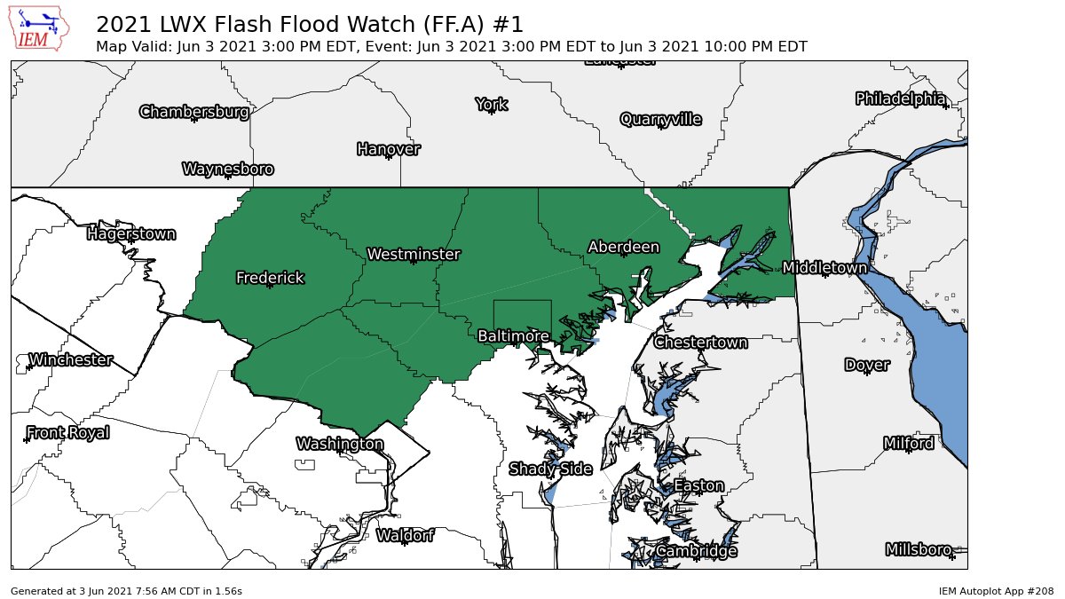
Good morning! The NWS has issued a flash flood watch for parts of our area including all of MoCo, Frederick County, Howard County, Carroll County, Baltimore and Baltimore County, Harford County, and Cecil County. This is from 3 PM EDT through the evening. Rainfall from numerous thunderstorms and showers will be around 1/2" across the region, but locally, where more thunderstorms develop, rainfall amounts could reach 2-4 inches.
"Heavy rainfall in a short amount of time can result in rapid rises of water in streams, creeks, and urban areas. A Flash Flood Watch means that conditions may develop that lead to Flash Flooding. Flash Flooding is a very dangerous situation. You should monitor later forecasts and be prepared to take action should Flash Flood Warnings be issued." - NWS
I will make a post updating about the potential of severe weather later today! Until then, stay safe, and stay weather aware.

I high appreciate this post. It’s hard to find the good from the bad sometimes, but I think you’ve nailed it! would you mind updating your blog with more information?
ReplyDeletemulch bel air md
Thank you! This is also an old post from 3-ish months ago, so this post isn't telling about the current weather events(Hurricane Ida).
DeleteYou can check my latest post(as of Sep 1, 2021) here:
https://mcpsweather.blogspot.com/2021/09/flooding-and-tornadoes-from-ida.html