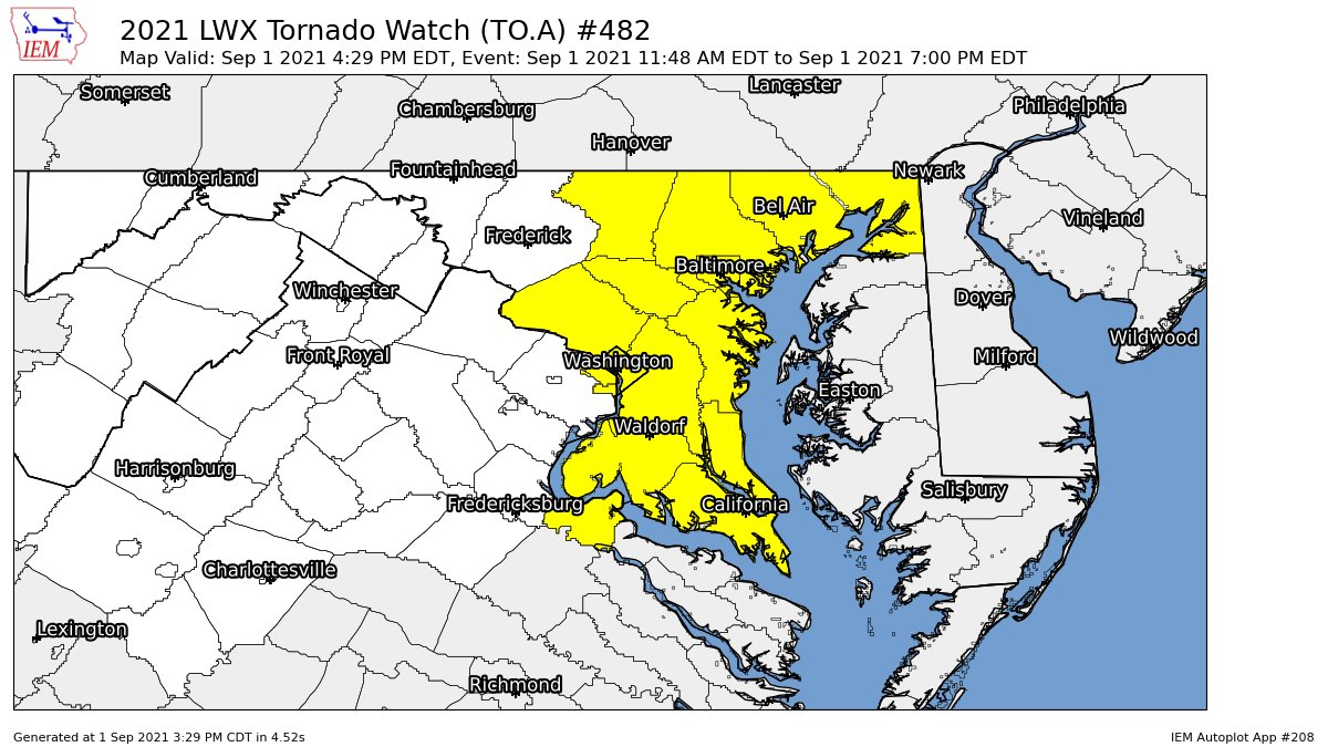
4:35 PM
The tornado watch has been trimmed down to only Maryland now.
4:25 PM:
The tornado threat is starting to decrease a little bit, but that doesn't mean that the threat is completely gone. There could still be some tornadoes. Flash flooding is still a concern though. The threat is enough to still pay attention to it.I'll update this post as new information comes in. I didn't make a post earlier because of some issues with the blog management, sorry about that!
Hello everyone! This is a test post from my new account that will be running this blog. This post won't be detailed or lengthy.
The tornado risk is at its greatest for the next few hours(2:30 PM Onward). 2000-2500 surface CAPE is in most locations in the DMV, and there has already been a wedge tornado in Anne Arundel County, including many others so far. There is a flash flood watch for the entire region, with a flash flood warning in Frederick county.


No comments:
Post a Comment