Thursday, February 24, 2022

Snowflake Prediction for Friday

My snowflake prediction for Friday is 2 snowflakes. Exact percentages are 55% delay, and a 10% chance for closure. The reason I'm leaning towards a delay is because the HRRR is now showing a lot more additional ice on top of what we already have throughout the night. Although temps do rise above freezing, there won't be enough time for it to melt for a full day. I think there won't be a closure because temps will rise very quickly above freezing and melt all of the ice. Even though the ice won't accumulate that much on sidewalks and streets, there will be some slick spots in areas with the simulation the HRRR is showing, at the very least. Some streets and sidewalks could be completely covered in ice, especially in areas like Damascus. The storm looks to be overpreforming a bit right now. HRRR isn't picking up on the freezing drizzle that is happening right now too. Temps dont get above freezing until 7 am on the HRRR for some parts of the county. Because of these reasons, I am confident in a delay but not in a closure. Remember: what the HRRR shows is ADDITIONAL ice. The WWA goes until 10 am for Northern MoCo.

Wednesday, February 23, 2022

Wintry Mix Thursday - Friday

Good evening everyone! We have a threat for a wintry mix from Thursday to Friday, mainly north of DC metro. Models have been trending south and colder for the past day or two. The highest ice will be near the mason dixon line. Unlike the other ice event that busted, this is a cold air damming event, which tends to be undermodeled. This will not be a snow threat, and the main focus of this will be ice and sleet. Although precipitation onset could be snow, almost all of it will turn into sleet/ice quickly. Precipitation onset has been delayed a few hours to after sunset, which would lead to a better environment for ice to accumulate. Main roads most likely won't be a problem, however secondary roads and sidewalks could have some slick spots, especially north of I-70 and in higher elevation areas such as Damascus. A potential delay is possible on Friday, but I won't make a prediction until we get into the event and surface obs.

Now, I will show what some model simulations are for this storm. 


RGEM/RDPS:

This is the RGEM model. It has done quite well this winter. The location of the ice accumulation is realistic, and fits with climatology. However, ice totals are still definitely overdone. The RGEM would give us a scenario for a delay, as ZR lasts in Damascus for until 11a-12p. This solution matches up more with surface temperatures. It has shifted south and colder compared to its last run.


Euro:


Euro is a bit more conservative with the ice totals, but still overdone in some places. It has shifted south and colder compared to its previous run. For Friday 1a, it gives Germantown rain on ptype map, when it should be ZR as temperatures are 32, supporting freezing rain. The Euro and RGEM line more up with my thinking and climatology on where ice accumulations will be.


About the NAM. It has a cold bias and spits out a very cold solution, with ice accumulation for even southern parts of our region. Although it does do well with CAD, it is quite unreasonable. Ground temps will not cool instantly, and NAM assumes it does. As I said earlier, it has a cold bias, so it is also unreasonable in the ptype solution it puts out. Even with later onset time, I just don't see it happening. 


Here is my first call ice map:


I will have an update with a school prediction for Friday and with mesoscale models + surface obs tomorrow.

Saturday, February 12, 2022

Superbowl Sunday Snow


Good afternoon everyone! Today is going to be a very nice day, with highs in the 50s to the2 lower-mid 60s. But as a cold front moves through, and a storm moves behind it, we will be tracking the threat for some snow. The NWS has most of the region(except for the southern part of the region, and western MD) in a winter weather advisory for 1-2" of snow, with local amounts up to 4" of snow. The onset of the storm will start out as rain/mix, but it will turn to snow quickly. Everyone will be snow by the time sunrise happens on Sunday. This will be a light event, and after noon you should be fine to travel. However there might be a refreeze after 4 PM, which could cause some slick spots. Most accumulations will be on grassy surfaces, however there could be accumulation on paved surfaces too. Minor travel issues and slushy spots are not out of the question. High resolution models are starting to pick up on an FGEN band that may occur at the start of the event, that would bring moderate-heavy snow rates. It would dynamically cool the atmosphere and combat warm surface temperatures. I'll look at 2 high-resolution models: NAM NEST & HRRR.


HRRR:

The HRRR shows precip onset as rain, quickly turning over to snow. At 1-3 AM you can see a moderate-heavy snow band in parts of the region. By 3 PM, snow is done for almost all of the region, but I skipped some timeframes at the end to show a backend snow band that the HRRR gives. 


This is the total accumulated snow that the HRRR gives. Remember, not all of it will stick, so actual totals will be a bit lower than this. Gives a widespread 1-3", but I'm skeptical of the widespread 3"+ in parts of north central MD.

This HRRR sounding at 2 AM Sunday shows something interesting. In the sounding, there is intense lift in the DGZ, which allows for moisture and moderate-heavy precipitation rates. This is an FGEN band because you can see the wind barb directions rapidly changing. If you are a snow lover you want to see this happen for more accumulation. This is important because this will dynamically cool the atmosphere to be cold enough to support snow, and would help to quickly overtake the warm surface temps.

NAM NEST:

The NAM shows the inital onset as rain before quickly changing over to heavy snow. It also shows the heavy FGEN band between 1-4 AM, and is actually a bit more robust with the onset of precip compared to the HRRR. It also has the backend snow band, but not as robust as the HRRR.


The snow accumulations are bit more robust compared to the HRRR, but around the same. 


The NAM NEST also shows a nice FGEN band setting up around 1-4 AM, with more lift in the DGZ than the HRRR, creating heavy snow rates. You can see the FGEN banding on the map below setting up, and on the sounding too. I explained what this means while talking about the HRRR sounding. 


Snow Forecast:

More detailed view of the map and interactive map:


The bullseye of this storm will be western central VA, where a FGEN band will drop 3-6" of snow. The FGEN band looks to be better supported there with longer duration leading to more totals. I expect a general 1-3" for most of the region, with C-1" for western MD and C-1" for the southern part of our region. Most accumulations will be in the grass, but there could be some accumulations on paved surfaces too, especially where the FGEN band sets up. Some travel issues and slushy spots on paved surfaces is not out of the question.


Saturday, February 5, 2022

MCPS going virtual for some snow days now -- new rating system

Unfortunately, the thing that I feared the most to snow days happened: MCPS is now going to go virtual for most snow days. However, there is a catch, thankfully. They will consider going virtual for inclement weather. This means that there will be some inclement weather days that will have a traditional snow day rather than a virtual learning. On a virtual learning inclement weather day, the schedule will operate on a 2 hour delay -- except it's on Zoom. Delays and early-releases will still operate as normal.

I will still be posting about weather that impacts the DC area, and still make school predictions about what MCPS will do, no matter what happens to snow days. 

I have updated the snowflake rating system and added a new rating system: 

The CHROMEBOOK rating system

The chromebook rating system is used to predict whether or not there will be a traditional snow day or a virtual learning day if MCPS needs to close in-person school for inclement weather. It is still undetermined what MCPS goes virtual for -- and what MCPS goes traditional snow day for. I assume that if there is a lot of snow -- especially wet, they will call a traditional snow day. It is still undetermined and no one knows what they will do what for since we havent gotten a snow day with this new rule in effect. 

Here is the new Chromebook rating system:

Most Likely Virtual Learning(if closure in-person):

1 Chromebook: Most Likely Virtual Learning

2 Chromebooks: 35% Chance of Traditional Snow Day

Most Likely Traditional Snow Day(if closure in-person):

3 Chromebooks: 55% Chance of Traditional Snow Day

4 Chromebooks: 75% Chance of Traditional Snow Day

5 Chromebooks: Most Likely Traditional Snow Day


And for weather news, there is a storm signal around February 14th(Valentine's Day) that I will be watching. It is still too far out to discuss anything about the storm -- at this point in time we just want to see if the pattern supports it. That is all for this post.


Friday, January 28, 2022

Fri-Sat Snow Map and NowCast

6:55 PM:

Snow starting to pick up here and stayed for a while before lightening a bit again. Looks like snow bands are going to struggle to come north, totals on the lower end of the ranges are expected now.

5:45 PM:
I now expect 1-3" for the general DC area, including MoCo. I think the 2-4" accumulations would be a good amount further SE than in my forecast. Southern MD is still on track on my forecast so far. We will see how the evening goes.

5:25 PM:

Moderate snow coming down here, stickage on grassy surfaces. Looks pretty good so far. After sunrise, temps will drop and snow will pick up, allowing for more stickage. Brunt of the storm is NOT over yet.

Sorry I didnt have any time to make a post, I'll just put my final call here. Accumulation should start to ramp up after sunset, and thats when snow will start to pickup. Generally expecting widespread 1-4" of snow throughout the region. I'll have an update at 5:30.

Monday, January 17, 2022

Delay possible tmrw

Based on the flash freeze that's going to happen overnight, and some side roads still being messy, I'm going to say a 45% chance of a delay(around 2 snowflakes) as of now for tomorrow. Side roads in many areas are still messy as the rain did not wash all of the slush away. Let's not forget about the flash freeze that will happen tonight, wet roads will quickly turn to ice. As of now I'm not leaning towards a delay, but it's more than possible.

Sunday, January 16, 2022

Final Call Snow & Ice Maps and Nowcast


These are my final call snow and ice maps. Almost nothing has changed for the snow map, but the ice map has took a change for the good: The 0.1-0.25"+ zone is now gone, and has been replaced with the 0.01-0.1"+ ice zone. Most people will only see up to a tenth of an inch of ice, but the plus is there for the mountains who will have cold air for longer, allowing for longer ice accumulations. Also some localized areas may see amounts just above a tenth of an inch. Cold air was undermodeled and WAA was overmodeled on high res models if you look at radar. This could mean a longer time period of snow, and just in general wintry precipitation. Surfaces will be below freezing for a while even when temps start to rise above freezing.

Saturday, January 15, 2022

MLK Weekend Storm - What to expect

Good afternoon everyone! We have a winter storm threat to track tomorrow and Monday morning. This threat is looking more like an ice threat instead of a snow threat; but if you live north and west of I-95 you will still see some snow accumulation for this storm. Unless you're far north and west(along and west of I-81), you probably won't see an optimal amount of snow - if you like snow. This storm takes an inland track - so being even a little bit more west can make a difference. When the snow starts, it will be heavy, with rates 1-3" per hour. When it snows, it will thump. Wind gusts up to 45 MPH are possible with this storm, creating the possibility of downed trees and spotty power outages, especially when ice starts to take over the snow. I would recommend to stay off of the roads(if NW of I-95) on Sunday-Monday, as the snow with ice makes roads very slippery and impassible at times. There is a very cold airmass in place for the storm, so ice and snow will stick longer to untreated surfaces. Please note that freezing rain can happen even above freezing, if surface temps and wet bulb are still <32. There is a winter weather advisory for all of MoCo, with 1-3" expected and up to 0.1" of ice. Just north of us is in a winter storm warning, for 2-4" of snow and 0.1-0.3" of ice.


NAM12KM:


Note: at the time where it shows pink for our area(7 PM), I looked at a sounding for Germantown/Gaithersburg and it would seem as if it would be sleet, rather than freezing rain. Still, you can see everyone starts off as snow, and then the warm nose comes in, turning into sleet, then freezing rain, and eventually, when the CAD breaks, cold rain. 


Ice total and snow total maps, pretty self explanatory.


NAM3KM:


The NAM high res shows everyone starting out as snow, then going to ice, and then going to plain rain. The NAM 3KM also shows some backend snow, which is interesting. However, it seems to be light snow, and probably wouldn't amount to much. A lot of the rain will wash all of the snow away, so even if 3" fell, it wouldn't look like it.


The reason why the NAM 3km shows a lot of ice is because of strong southeasterly upper level winds, forcing warm air into the atmosphere and creating a warm nose that gets more dense as time goes on. Eventually, the cold air at the surface breaks, and areas east of I-81 switch to cold rain.


 One other thing I want to talk about is the wind gusts. At this time(8P Sunday), freezing rain is falling all throughout the region. With the strong wind gusts(40-50 MPH wind gusts), isolated power outages and downed trees is likely. I would recommend everyone north and west of I-95 to get ready to deal with some time w/o power, just in case.

*Editors Note: While I was writing this, the 18z NAMs came out, all of the models shown are from the 12z suite

My snow and ice forecast:

(I apologize for very low quality maps, Blogger won't let me put high quality pictures) 


My next update for these maps will be tomorrow morning, after 12z mesoscale runs come in. I'm going bullish with my forecast because I think there will be heavy enough rates for a large enough area to get 2-4" before the changeover to sleet, freezing rain, and then cold rain. I think the NAM is too bullish on the warm air coming in very quickly and changing over to rain, so I didn't use the NAM that much in my forecast. Other models look pretty good for our region in terms of snow, such as the Euro, GFS, and HRRR. My final call WILL be tomorrow morning, after 12z HRRR, and both NAMs come in.

To conclude, I expect 2-4" of snow(possibly more in localized areas) for Northern MoCo and 1-3" for Southern MoCo. For ice, I expect 0.1-0.25" of ice for the general area, with possibly more in localized areas. Timing onset will be in the afternoon, at 1-3 PM. This will be a high impact storm, especially west of I-81, and also for NW of I-95, not just for snow, but for ice. I am very concerned about the ice threat, since CAD is usually undermodeled, especially on global models, and the ice combined with the strong wind gusts could create widespread power outages and downed trees. I'll have a quick update tomorrow, and then I'll do a nowcast.


Thursday, January 6, 2022

Final Forecast Jan 6-7 Storm

Good evening everyone! The models have trended for lower totals and lower QPF, however this event still shouldn't be too bad, with 2-4" still expected. I'll only be showing 3 short/medium-range models(NAM, NAM NEST, and HRRR), my snow forecast, the NWS forecast, and my snowflake prediction.


NAM NEST:


The NAM NEST(higher-res version of NAM) shows a heavy band hitting a lot of the area between 1-3 AM. NAM 3km actually looks pretty accurate to what we are seeing on radar, except that the fact that radar has the storm a bit more amped. Anyways, shows widespread 2-4", with some localized areas getting higher than that.

NAM:


The NAM shows a pretty decent solution for this storm, with 3-5" north and west of DC, and 1-3" DC and south. It shows a moderate-heavy band that hits many of the DMV, with the highest totals being north and west.


HRRR:


The HRRR shows light-moderate snow for most of the storm, with a moderate-heavy band moving through between 1-3 AM. Compared to both of the NAMs, this model is more conservative for the snow totals, with 1-3" for most of the region(some areas 2-4"). 

NWS Snow Forecast(forecasted, and high-end all in respective order):
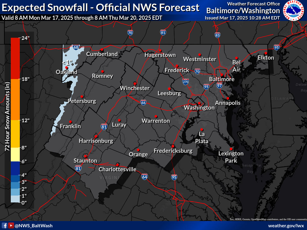
Expected Snowfall - Official NWS Forecast


My Snow Forecast:


This is my snow forecast. Latest guidance shows heavier snowfall(2-4") being reserved to north and west of DC. Most of MoCo is in the 2-4" area, except for very southern MoCo. The reason I went 1-3" was because of dry slotting, a common thing which happens in Miller Bs such as this one. The initial low pressure weakens, and the new one forms. When this happens, it allows dry air to come in, which would reduce the snow totals from this storm. Hence the 1-3" area was expanded. If you live in Northern MoCo, and any areas N & W of it, I think you should be fine for the dry slotting. Will have to watch closely.


My Snowflake Prediction: 

3 snowflakes

55% chance of a closure, and a 75% chance of a delay

The reason why I think we have a good chance of closing is because of the temperature, and winds tomorrow. Temperatures will not rise above freezing for almost all of the county tomorrow, meaning that whatever stuck will stay there. Additionally, it is supposed to be windy tomorrow, and a fluffy snow is expected, meaning that blowing snow is another hazard that needs to be worried about. Even though totals are more on the lighter side, it will be more than cold enough for the snow to immediately start sticking to untreated surfaces. If we get the high-end amounts, I am more than confident in a closing. As of now, I am a bit unsure on whether to lean towards a delay, or a full-on closing. I will change the chances as new information comes in. Needless to say, I am pretty sure there will at least be a delay.


Wednesday, January 5, 2022

Snow Threat Jan 6th Night - Jan 7th Morning

Good evening everyone! The NWS has put a winter weather advisory for the entire region, with 2-4" expected, and up to 5-6" in isolated areas. The usual trend of north and west getting more snow is back. Models have been all over the place with this event, and especially with the low placement. The snow will arrive tomorrow night, and there will be enough to shovel and plow. There won't be as much as 1/3 gave to SoMD, but there will still be a moderate amount of snow. Heaviest snow will be around midnight for Northern MoCo, with rates up to around an inch per hour. Where the frontogensis bands setup is where the heaviest snow is going to be. According to Sterling's AFD a short term winter storm warning may be required if a band persists over a specific localized area. Temps before the event will be much colder than 1/3, and it will be below freezing the entire time the snow is falling, so snow will have no problem sticking on untreated surfaces. This snow will be easier to shovel as it is a more dry, fluffy type of snow.

GFS:


This is the model that shows a more southern solution. 18z run had a more amped storm with less confluence, allowing the storm to go more a bit more NW. Still shows 1-3/2-4" for most of the region with 4-6" in SoMD.


NAM(High-Res, 3km):


The NAM is a more northern solution, and shows more snow for our area in general, 3-6" for most areas north of DC and 2-4" south. The influence of dry air for the northern part of our region may cut down on totals. That will be the more difficult part, finding out where the dry air sets up. 

NWS Forecast:


(sorry for low quality image, blogger wouldn't let me adjust the size of the high-quality image)


My Snow Forecast:


Snowflake Prediction: 3 Snowflakes


With temperatures being cold enough the whole day to support snow(<32 for most of the county), and there being 2-4" during the start of the rush hour, would pretty much confirm a delay. Additionally, if the heavier bands setup over our county, giving some areas warning level snow, that would take much longer to cleanup and cause more issues. The new superintendent seems to be more lenient with giving out snow days, at least so far, which is good. There is a pretty decent chance for schools to be closed tomorrow, and depending on how models go tomorrow, that chance may increase or decrease.


Featured Post

Archival of Blogger and Move To Substack

Hello everyone, I'm making this post as a formal gesture that I have fully moved to Substack and will not be using this website anymore....