Sunday, December 26, 2021

Wintry Mix Tomorrow

Good evening everyone! Tomorrow morning, some freezing rain, sleet, and snow is possible for our northern areas. This event will not be significant at all, and I expect minimal accumulations, up to a coating of slushy snow; with all of the (possible) accumlation on grass, with roads staying wet.  Those small amounts may not even occur in the first place. A cold front pushing through this evening creates dew points below freezing, with surface temperatures in the 30s(mainly for northern areas). The event will start out as sleet or snow for northern areas, and then switch over to rain as soon as temps rise. Other than the mountains, icing/snow will not be a threat due to how warm its been recently.


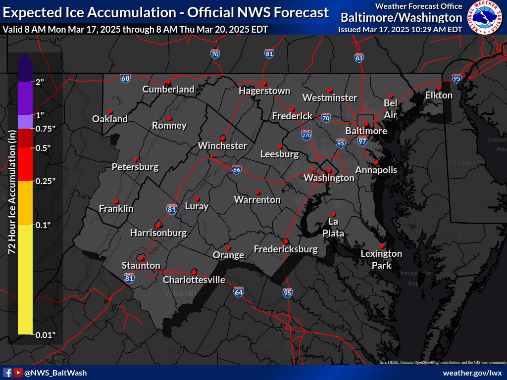
These are the winter weather maps expected by the NWS:
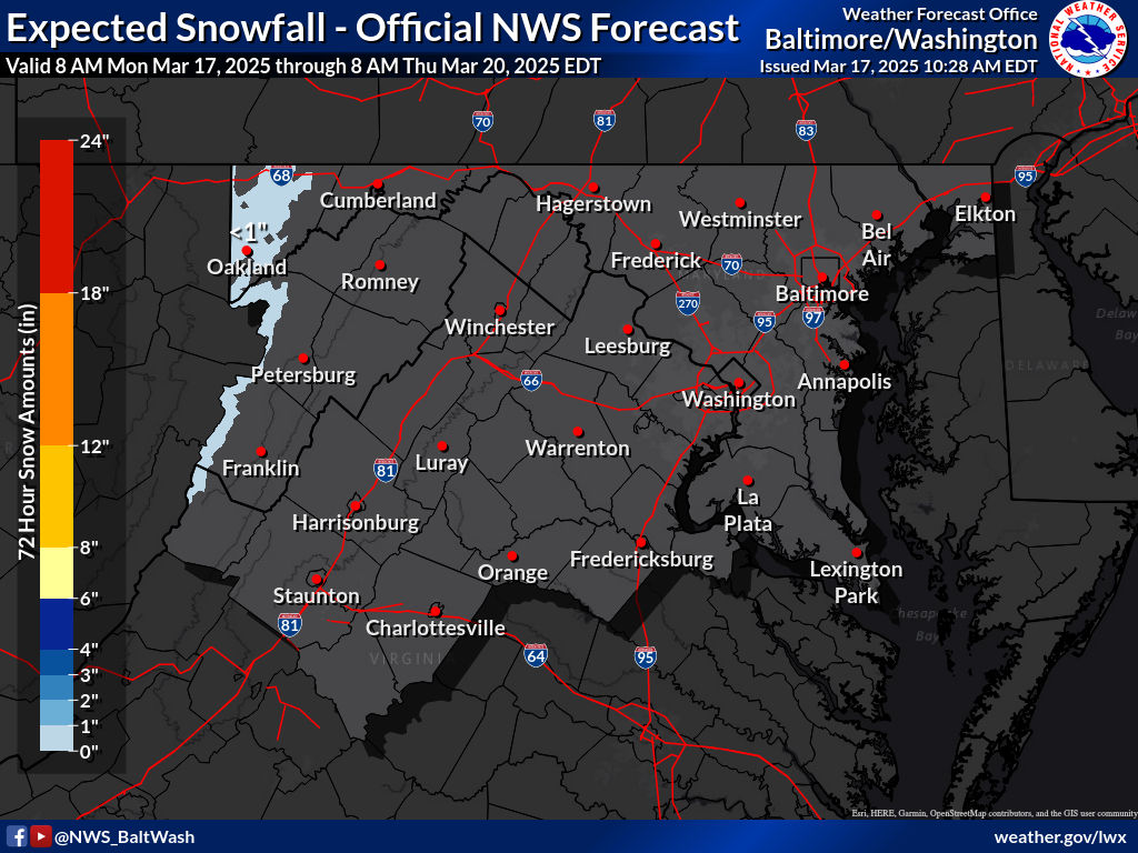
Expected Snowfall - Official NWS Forecast 

Most Likely Ice Accumulation 

Plume for Northern Maryland(Frederick):

As you can see, this plume shows all type of precipitation, with rain being the dominant precipitation. It shows pink(sleet), red(freezing rain), blue(snow), and green(rain). It shows it starting in the early morning, and then as temps rise, the cold rain starts to take over the mix, and eventually wins over the wintry precipitation. The plume mean shows a trace-dusting of snow for Frederick, Maryland. When the rain chances increase in the plume, thats when the precipitation get mixed with rain.


This is the 0z HRRR for tomorrow. It shows an early batch of rain quickly moving through before the snow and mix arrives. When the quick batch of rain arrives, its not cold enough at the surface to support wintry precipitation, so therefore the precipitation falls as rain. However, when the heavier precipitation comes to our area, upper level temperatures are cold enough to support wintry precipitation even with mid 30s at the surface. If the snow falls at a heavy enough rate, there could be a light coating on the grass in some areas. 

To conclude, a wintry mix that transistions to rain is likely if you live north of DC and I-66. It may lead to a possible slushy coating, especially in our more far northern areas. This event will not impact the roads or sidewalks, unless you travel north of the Mason-Dixon line, where WWAs are posted. Precipitation becomes less likely south of DC, and these areas will see just rain, with a very very low chance of mixing.

Monday, December 6, 2021

First Snow Threat of the Season(mini-post)

Good evening everyone! I don't have enough time today to show all of the models and explalin all of my thoughts, so this will kind of be just like a mini-post. I will be getting straightforward to the point starting now. 

The 12z and 18z models are looking pretty decent for us snow-wise. The european model will just not cave to the NAM/GFS/CMC, all which support a snowier solution. The GFS has remained incredibly consistent this whole time, with support from NAM and CMC. NAM high-res shows us dryslotting and not getting that much snow sadly.
Snow Accumulation Prediction
 

As of now I will say a coating to 2 inches of snow for this system on Wednesday. More northern and western areas will see more, you already know the deal with that. Most of the accumulation will be in grassy areas, however it is possible that some roads and sidewalks may be slick/slushy, mainly in our north and western areas(Northern Montgomery County, Loudoun County, Frederick County, etc.). Unless you live quite far south and east, the main precipitation type will be snow throughout the whole event.

And for school predictions... This will be the first time doing this in almost 2 years so I have a decent chance of being inaccurate(plus new superintendent, we will find out how lenient she is with snow day). The main threat isn't really accumulation roads, it is the low visibillity with moderate-heavy snow plus somewhat threatening conditions while the snow is falling. The GFS/NAM shows areas east of I-81 getting hit by a heavy FGEN band(heavy snow band), which could create localized totals of up to 2 inches of snow. It could be heavy enough to stick to some sidewalks and roads.
 

So I will go with: 

2 snowflakes, leaning towards a full day(Somewhere around 45-49% delay)


This could go the other way if the snow comes later in the day and we could see an early-dismissal. This is my first call prediction, and likely will change. Most forecasts have us in the snow region of a trace to 1 inch of snow, and I agree with them. However, the NAM/GFS have been showing this band hitting us for quite a while now, and I can't just rule it out. If this happens, we could very well see some areas getting over 1 inch, and that's why I will be including up to 2 inches in my forecast. There could be a winter weather advisory, but thats only if the NWS gains more confidence in our county getting >1" of snow. If it does get issued, I would say only the northern region will get it from this point out.


Saturday, November 27, 2021

Update on First Flakes Today Night and Sunday Early AM

The midnight models yesterday trended towards more parts of our region getting flurries/snow showers. The best chance of snow is late tonight and very early on Sunday morning. The more inland and north you are, the better chance you have of seeing snow. The mountains will be seeing a couple of inches of snow from this system. As for us, the snow chances go down as far south as northern DC. When the snow falls, it will be above freezing in most of the region. Sunday's highs will be in the mid-upper 40s which is generally too warm for snow; hence the main time for snow being very early Sunday AM. Mixing is likely in non-mountainous areas; especially when temps rise; and especially for areas that remain above freezing during the whole event.

HRRR:

The HRRR shows light snow for many parts of the region(any area that is above the blue 540 line should be snow, and not rain, the rain is a model error if it shows rain for a region above the 540 line). I don't know if it will go this south, but if it does, it will definitely mix with rain. Most areas(including all of MoCo) are above freezing; and the closest I saw to freezing for Northern MoCo would be 32-33 degrees in this model run. However, it still does show parts of our region getting flurries/snow showers.

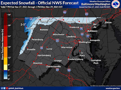
This is the NWS map for accumulating snow(not flurries that fall and don't accumulate; just stickage). With the afternoon runs coming in a little warmer, I agree with this map. Only extreme northern and western areas will see accumulating snow; and unless you are in the Applachian mountains it will be less than one inch.


Overall this won't be anything impactful unless you are located in a mountain range. North and west areas have the best chance to see flurries/snow showers; and the further south you the chance decreases. The best chance is late tonight and Sunday early morning.

Friday, November 26, 2021

First Flakes Possible on Sunday

Good evening everyone! As you might have heard already, many parts of our region saw their first wintry weather this morning. I personally got sleet/snow mixed with rain that melted instantly. It was too light to really see, but based on the way it melted, reports around me, and radar, I was able to determine the PType. The main chance for flurries around the region will be on Sunday, and maybe Tuesday(Ill go over this soon). If you look on the models, it doesn't seem anything will be hitting us, but models usually miss these type of flurry events. The trend has been for this clipper to start earlier, which means that it will be colder when the clipper starts; therefore making conditions more substantial for snow. As usual, north and west areas have the best chance to see flurries. The best chance for snow, or a mix of snow will be in the morning and evening/night. There is expected to be no accumulation with this system, as snow rates will be too light.

This is the plume for KFDK(Frederick Airport), and it shows when precipitation falls, and what time it happens. At around late Saturday night/early Sunday morning, it shows snow starting to fall, and then as the time goes on the chances of rain start to increase and eventually it gets to a point where the snow rate starts to decrease and gives into rain. Later in the day it shows rain stopping and a little(small) amount of snow at the end. (The blue at the end is for Tuesday).


This is the plume for KIAD(Dulles, further south), and it shows a similar thing except that the snow lasts less longer and there is more rain(also some freezing rain weirdly pops up on this). When rain chances start to increase with snow, you can expect some mixing.

Featured Post

Archival of Blogger and Move To Substack

Hello everyone, I'm making this post as a formal gesture that I have fully moved to Substack and will not be using this website anymore....